

3 THINGS TO KNOW
- Record highs in the 90s on Saturday
- High wildfire risk this weekend
- No rain expected for next 7 days
FORECAST
With warmer and drier air in the forecast this week, wildfire conditions will be high over the next 7 days. Hold off on burning anything.
This will be a very warm evening around the region with temperatures in the 60s/70s. We'll start Saturday morning near 50 degrees.
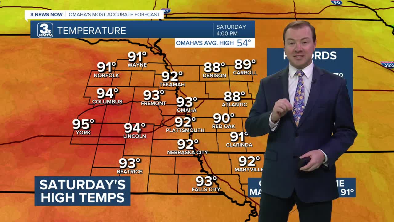
Saturday will be even warmer and record highs are likely across the region. Highs will be in the low 90s across all of eastern Nebraska. Western Iowa will reach the upper 80s. The record high for Omaha is 87. This will likely be the earliest Omaha has reached 90 degrees, and the warmest day ever in March.
The air will be EXTREMELY dry, with humidity values of 8-13%. Hold off on burning any brush piles and be careful with BBQ grills and fire pits. Saturday's wind will be round 10-25 mph.
The second half of this weekend will be cooler and breezy with highs dropping in the low 60s by Sunday afternoon. As of now, no rain comes from this cool-down. Winds will be gusting out from the north at 25-40 mph.
Next week continue the dry, milder pattern into next week, starting in the 50s/60s on Monday and Tuesday. Rain looks very limited over the next 7 days, but we may see some rain by the end of next week.
FRIDAY NIGHT
Mostly Clear
Mild
Low: 50
Wind: W 5-15
SATURDAY
Mostly Sunny
Record Highs
High: 93
Wind: W 15-25
SUNDAY
Partly Sunny
Cooler & Breezy
High: 63
Wind: N 25-40
MONDAY
Partly Sunny
Near Average
High: 58
Wind: E 5-15
Share your weather pictures with KMTV:
- Email to News@3newsnow.com
- 3 News Now Facebook page
- Use the hashtag #3NewsNow on Instagram or X (formerly Twitter)
