

3 THINGS TO KNOW
- In the 90s Friday
- Storms possible Friday evening through Monday night
- Severe weather possible this weekend
FORECAST
The wind will relax and calm down later tonight. Skies will stay partly cloudy tonight with lows near 60 degrees.
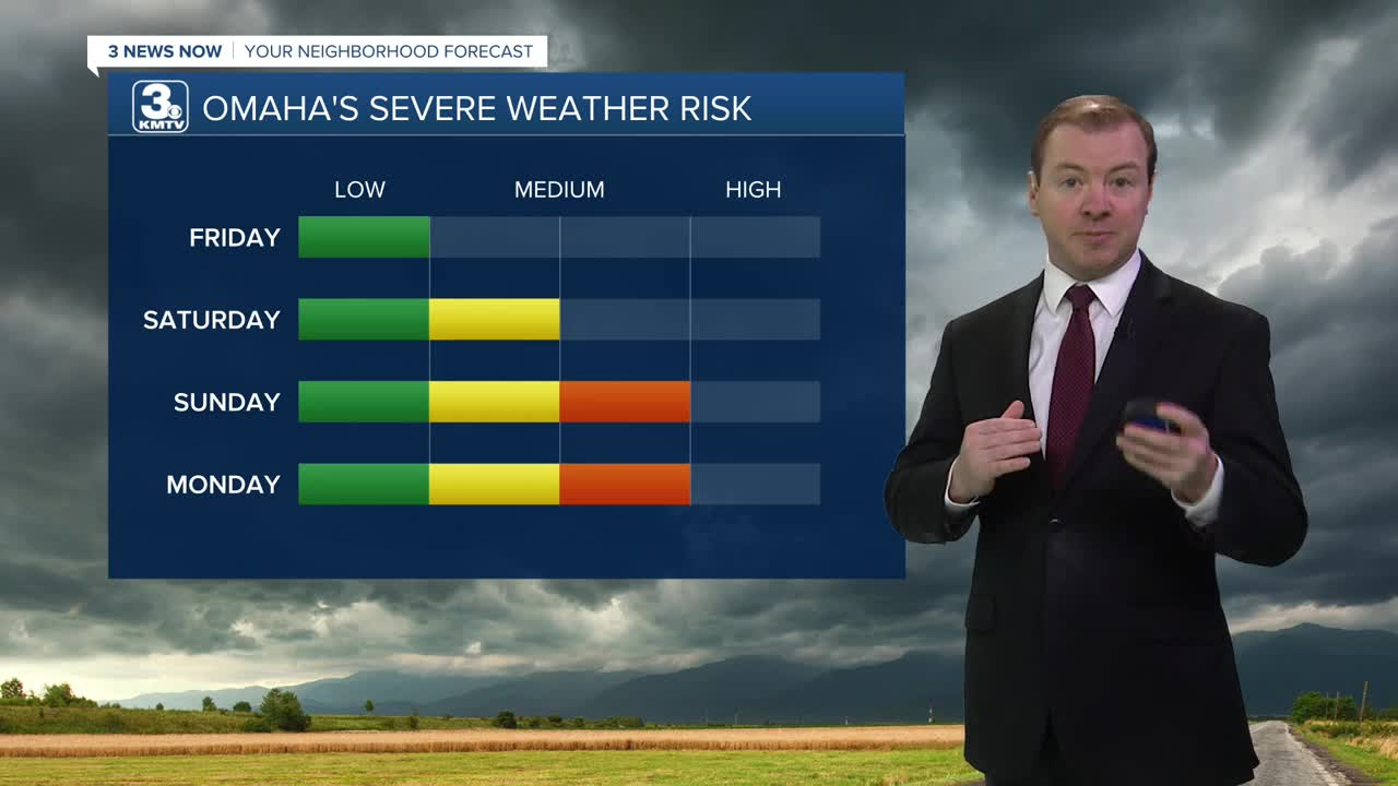
Friday looks hot with mostly sunny skies and highs in the low 90s. It will be a drier heat. Winds will be calmer, around 10-20 mph. We have a chance at a few isolated storms developing around 5-6pm Friday evening across Omaha and southeast Nebraska. These storms will be capable of large hail and frequent lightning.
More storms are likely over this upcoming weekend, and could come with a few rounds of severe weather. Saturday will be partly cloudy and dry for most of the day, with rain chances becoming more likely after 3-4pm, and continuing through the evening. These Saturday storms will be capable of large hail and damaging winds. Overnight storms may be strong, but the severe weather threat looks low Saturday night.
After some morning dry weather, thunderstorms on Sunday could develop as early as 3pm, continuing through evening. These Sunday storms may be capable of all severe storm hazards.
More severe weather is now likely on Monday, where all severe storm hazards are possible.
A cold front is expected to sweep through Omaha early Tuesday morning, leaving the region drier and cooler with highs in the low 70s Tuesday through Thursday.
Rainfall amounts could total around 0.50" to 1.50" from now through next Monday, May 18th.
THURSDAY NIGHT
Mostly Clear
Mild
Low: 60
Wind: SE 10-15
FRIDAY
Sunny & Hot
Evening Storms
High: 93
Wind: S 10-20
SATURDAY
Partly Sunny
Evening Storms
High: 89
Wind: S 10-20
Share your weather pictures with KMTV:
- Email to News@3newsnow.com
- 3 News Now Facebook page
- Use the hashtag #3NewsNow on Instagram or X (formerly Twitter)
