

3 THINGS TO KNOW
- Light wintry mix Wednesday evening
- Getting very warm Thursday and Friday
- More chances at snow late weekend
FORECAST
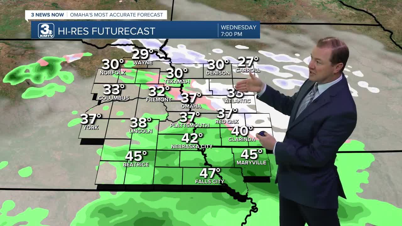
A light wintry mix will move through Omaha this evening. Air temps will be above freezing for most, which will melt any snow. But for those who live in western Iowa, some minor snow amounts less than 1" will be possible. Roads may be slick for a few hours while this passes through.
By midnight, this system exits and we are on to clear, sunny skies for Thursday morning, in the upper 20s for temperatures.
We start a warming-trend again with highs on Thursday jumping in the upper 50s to low 60s.
Friday will be even warmer with highs in the mid to upper 60s and lots of sunshine!
A cold front does arrive Friday night, which cools things down closer to normal for this weekend.
We drop to near 40 on Saturday, and the low 30s on Sunday. There is a chance for additional snow Sunday and into Monday of next week, and some accumulations may be possible. This system is still over the Pacific Ocean, west of California. We should have a better idea on amounts/impacts once this arrives onshore Friday/Saturday.
WEDNESDAY NIGHT
Cloudy
Patchy Fog
Low: 27
Wind: NW 5-10
THURSDAY
Sunny
Pleasant
High: 58
Wind: W 10-15
FRIDAY
Sunny
Mild!
High: 67
Wind: SW 10-15
Share your weather pictures with KMTV:
- Email to News@3newsnow.com
- 3 News Now Facebook page
- Use the hashtag #3NewsNow on Instagram or X (formerly Twitter)
