

WHAT TO KNOW:
- Light snow on Monday morning
- Extreme cold hit's Wednesday night, temps below zero
- Back in the 30s by the end of the week
FORECAST:
Our skies will remain mostly cloudy Sunday night and temperatures will down in the mid 10s by Monday morning.
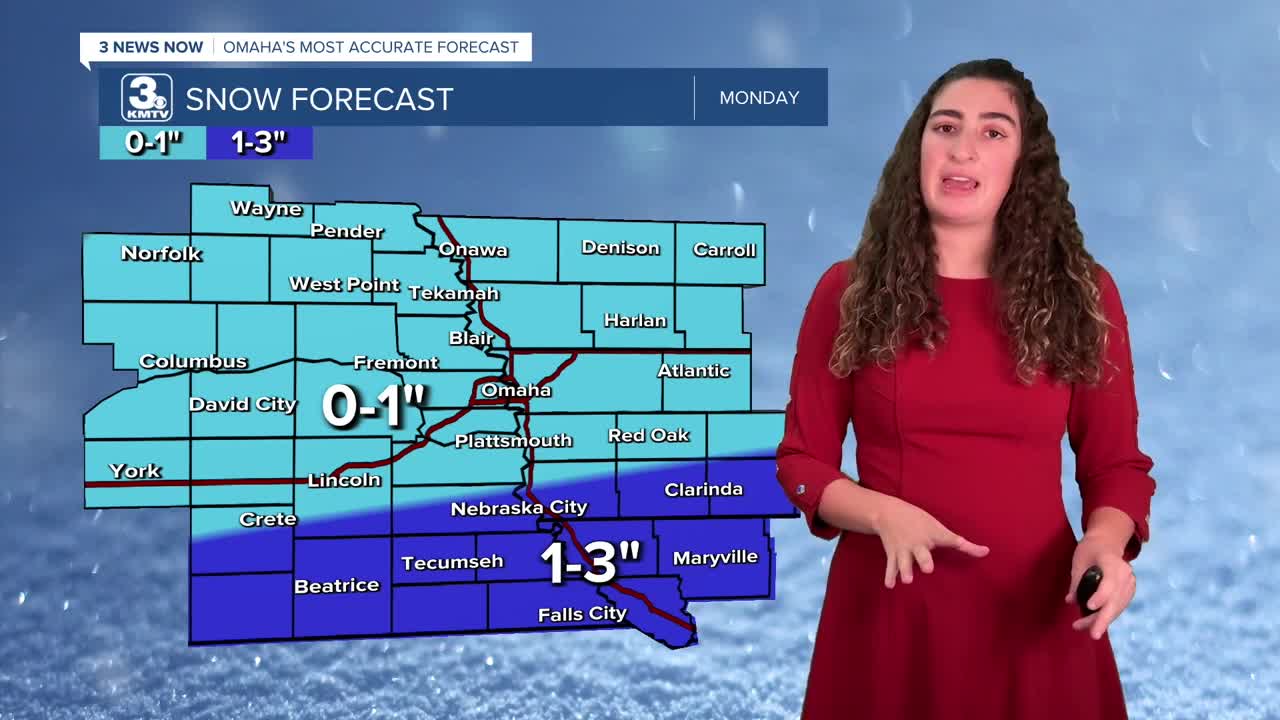
Another round of light snow will move in after 3 AM Monday morning. Not everyone will see the snow. Those that live north of Omaha may only see snow flurries in the morning. The chance for accumulating snow is higher south of Omaha. Expected snowfall amounts should be lighter than this recent snowstorm, with most of us seeing under 1", though our southern counties could see over 2", but no more than 3" through Monday afternoon.

The snow exits for most by Monday afternoon, and highs will only reach the lower 20s.
Tuesday will be a bit "warmer" with highs getting to near 30 degrees. With some sunshine, that should be able to get some snow to melt.
Wednesday will even warmer, with mid 30s for highs. However, we get a strong cold front Wednesday afternoon that will send temperatures down below zero by Thursday morning. At this time, there does not appear to be any accumulating snow from this cold front.
Thursday morning's wind chill will be down around -10 to -15. Thursday will be sunny, but cold with highs in the upper 10s.
We slowly climb out of the bitter cold by the end of the week into the weekend, with low 30s on Friday and Saturday.
SUNDAY NIGHT
Mostly Cloudy
Cold
Low: 15
Wind: NW 5-15
MONDAY
Cloudy
Light AM Snow
High: 22
Wind: S 5-10
TUESDAY
Mostly Cloudy
Not As Cold
High: 31
Wind: S 5-10
Share your weather pictures with KMTV:
- Email to News@3newsnow.com
- 3 News Now Facebook page
- Use the hashtag #3NewsNow on Instagram or X (formerly Twitter)
