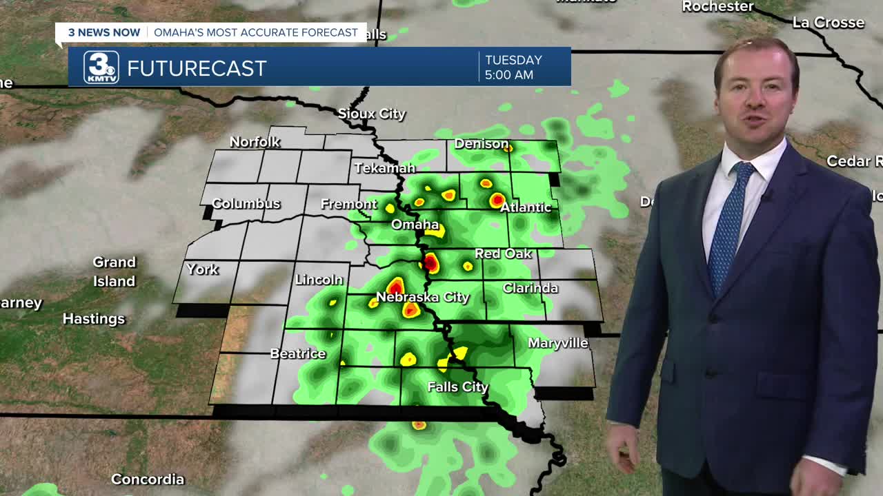


Overnight, another round of rain will be possible, developing around 1-2 AM and continuing through the start of Tuesday morning. The best locations to see this rain will be near/south of I-80, where there could also be some pockets of heavy rain. No flooding issues are expected. It will be a lot warmer out than the recent mornings, with low 60s to begin the day.
The morning chance at rain will continue until noon. Tuesday afternoon will then be mostly sunny with upper 70s and less breezy winds.
We start to warm up above average Wednesday and Thursday with mostly sunny skies and highs in the mid 80s. The average high for September 10th is 82 degrees.
It will be breezy for the end of the week as even warmer air moves into the region, pushing afternoon temperatures on Friday and Saturday into the upper 80s to near 90. Friday looks dry, but by the end of the day Saturday, we could see some storms move in from our west.
Sunday will be partly to mostly cloudy, with a chance for storms and highs in the lower 80s. We'll keep the small chance for rain into Monday of next week.
TUESDAY
Partly Cloudy
AM Rain
Seasonal
High: 79
TUESDAY NIGHT
Partly Cloudy
Warmer
Low: 62
WEDNESDAY
Mostly Sunny
Warm
High: 84
THURSDAY
Mostly Sunny
Warmer than Average
High: 86
Share your weather pictures with KMTV:
- Email to News@3newsnow.com
- 3 News Now Facebook page
- Use the hashtag #3NewsNow on Instagram or X (formerly Twitter)
