

3 THINGS TO KNOW:
- Winds calm down tonight
- Cooler, in the 40s Friday & this weekend
- Even warmer for the holiday week
FORECAST:
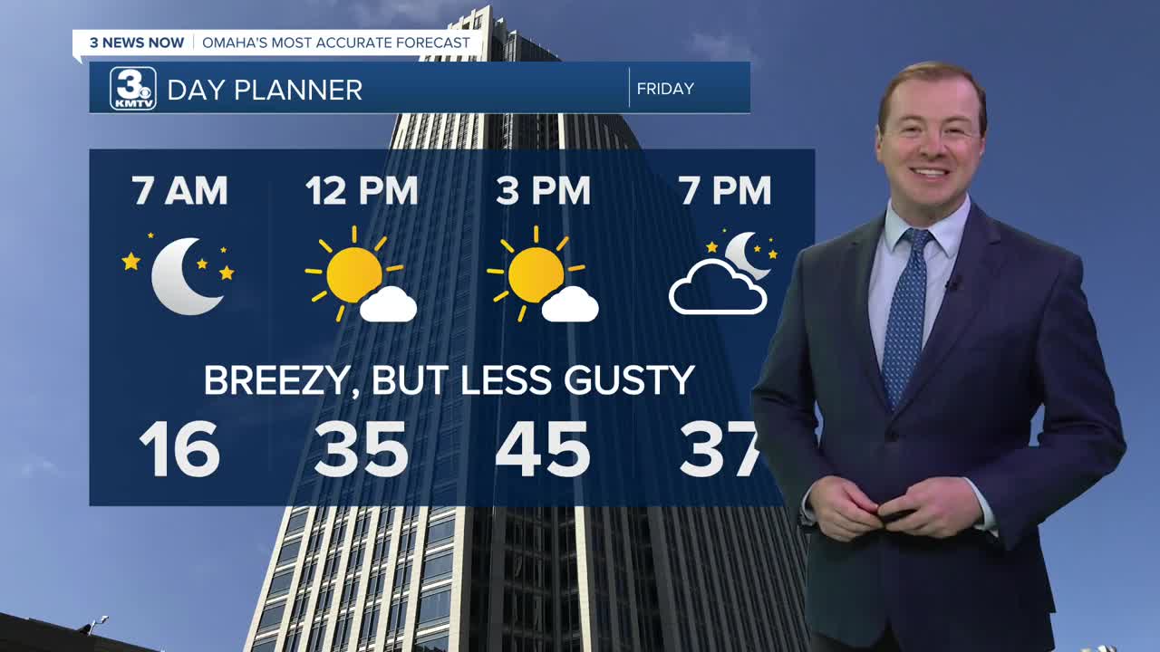
The wind will start to settle down overnight, becoming calm by Friday morning. It will be a cold start to Friday, in the mid 10s.
The wind picks back up again Friday, but this time it's out from the south, helping steer warmer air back our direction. It less "blustery", and we should see a mostly sunny sky. Friday's highs will be in the mid 40s.
We'll see a mix of clouds and sunshine over the weekend, and we'll be slightly above average on temps, especially at night. Saturday will be partly sunny with highs in the mid 40s. Sunday will be partly sunny with highs in the low to mid 40s.
We're right back on another warming trend for the start of next week. Monday will be mostly sunny and breezy with mid 50s for highs!
Some extra cloud cover moves in for Tuesday and Wednesday, but we stay in the low 50s.
Christmas Day is Thursday, and Omaha's chance for a "white Christmas" appears near zero...However, we are looking at potential record highs! Right now, we should be near 60 degrees. The record high for Christmas Day is 57, set in 1946.
The next chance for any measurable precipitation would be the weekend after Christmas. Travel disruptions for the region appear low at this time.
THURSDAY NIGHT
Mostly Clear
Cold
Low: 16
Wind: NW 10-15
FRIDAY
Mostly Sunny
Warmer
Breezy
High: 45
Wind: S 15-30
SATURDAY
Partly Sunny
Above Average
High: 44
Wind: S 10-20
Share your weather pictures with KMTV:
- Email to News@3newsnow.com
- 3 News Now Facebook page
- Use the hashtag #3NewsNow on Instagram or X (formerly Twitter)
