

3 THINGS TO KNOW
- Cloudy, foggy Tuesday
- A big warm-up later in the week
- Thunderstorm chances Thursday night, Friday
FORECAST
It will be a cloudy night around Omaha and there may be a few pockets of drizzle, or sprinkles. Some patchy fog may develop overnight as temperatures drop in the low 30s for Tuesday morning.
Our skies stay cloudy on Tuesday with a little patchy fog in the morning. Pockets of light rain may be possible during the day, but most of us will stay dry. Highs will be near 50.
Some sunshine returns on Wednesday, and it will be slightly warmer out with highs in the mid 50s.
A big warm-up is on the way starting Thursday, but it end with rain chances. We'll see plenty of sunshine Thursday with highs in the upper 60s.
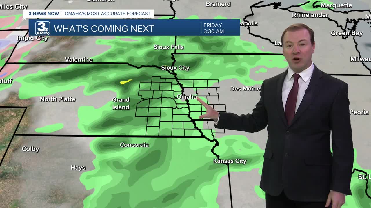
Heading into Thursday evening, rain and a few thundershowers will begin to move in from the south, becoming scattered Thursday night before clearing up Friday morning.
We should see a few dry hours and some limited sunshine to get temperatures back in the upper 60s by early Friday afternoon before another round of showers and thunderstorms develop ahead of a cold front across eastern Nebraska. A few of these storms could reach severe levels in the afternoon if conditions are right. Rain will continue into Friday evening, clearing out late Friday night.
Things will dry out over the weekend and we see lots of sunshine. Temperatures will be in the 50s on Saturday, and 60s for Sunday.
MONDAY NIGHT
Mostly Cloudy
Drizzly & Foggy
Low: 34
Wind: SE 5-10
TUESDAY
Cloudy
Pockets of Drizzle
High: 50
Wind: NE 5-10
WEDNESDAY
Partly Cloudy
Dry
High: 54
Wind: N 5-10
Share your weather pictures with KMTV:
- Email to News@3newsnow.com
- 3 News Now Facebook page
- Use the hashtag #3NewsNow on Instagram or X (formerly Twitter)
