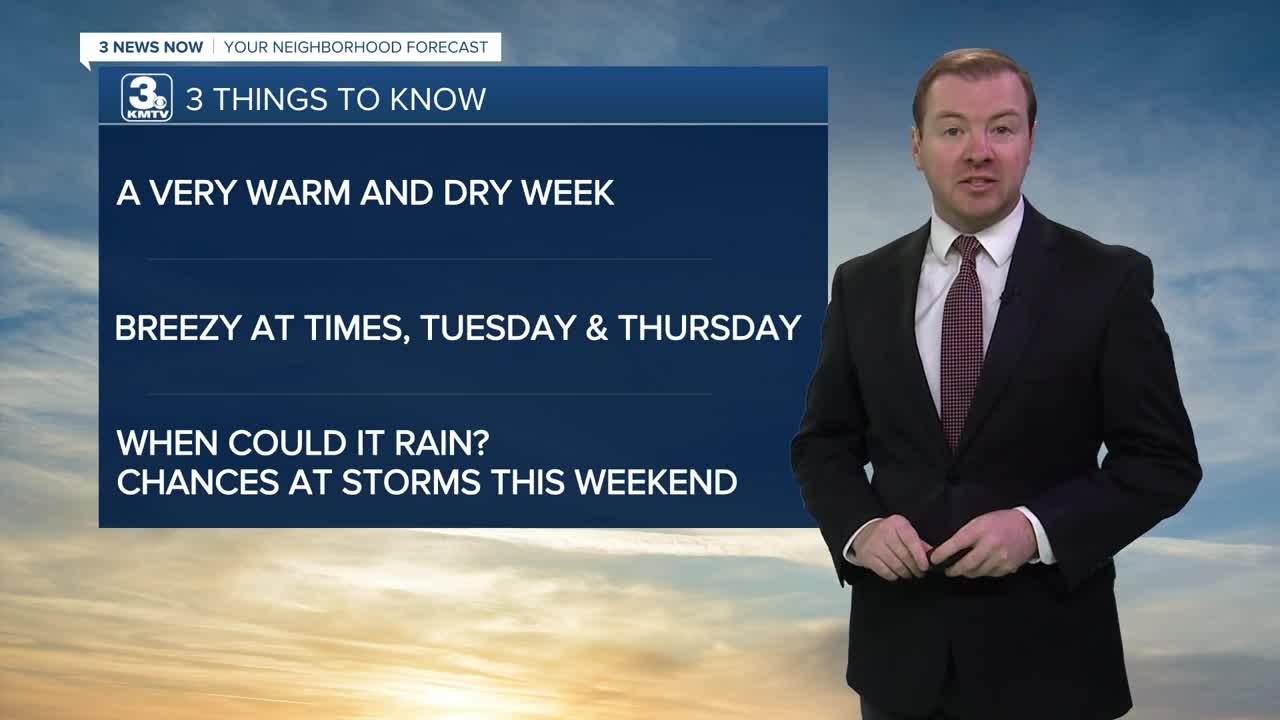


3 THINGS TO KNOW
- Highs in the 80s this week
- Breezy at times, higher wildfire danger
- Looking hot by the weekend
FORECAST
A passing cool front on Tuesday morning may bring in some extra wind and a sprinkle or brief light rain showers. Most will be dry. By the afternoon, we are back into some sunshine with highs on Tuesday still reach the low 80s. Winds out from the northwest will be very dry and gusting to around 30mph, leading to higher wildfire conditions. The wind will calm a little by Tuesday evening.
We stay mostly sunny Wednesday with highs near 80, which is about 7-10 degrees warmer than average for right now.
The wind returns on Thursday as a warm front moves through the region. This may bring a few isolated rain showers, but mostly will stay dry. Wind gusts could reach 35-45mph, which may heighten fire danger; avoid any outdoor burning. Highs will be in the mid to upper 80s.
It gets even warmer in Omaha on Friday, with a few neighborhoods hitting the 90s. We stay very warm on Saturday too, with highs again near 90.
There are chances for rain over the weekend, but the probabilities are under 30% for now. The best rain chance would be Saturday night or Sunday.
MONDAY NIGHT
Mostly Clear
Mild
Low: 61
Wind: SW 10-15
TUESDAY
Partly Sunny
Breezy
High: 82
Wind: NW 15-30
WEDNESDAY
Sunny
Warm
High: 80
Wind: NW 5-15
Share your weather pictures with KMTV:
- Email to News@3newsnow.com
- 3 News Now Facebook page
- Use the hashtag #3NewsNow on Instagram or X (formerly Twitter)
