

3 THINGS TO KNOW
- Near record highs later in the week
- Wildfire conditions remain elevated
- No rain expected for next 7 days
FORECAST
With warmer and drier air in the forecast this week, wildfire conditions will be high over the next 7 days. Hold off on burning anything.
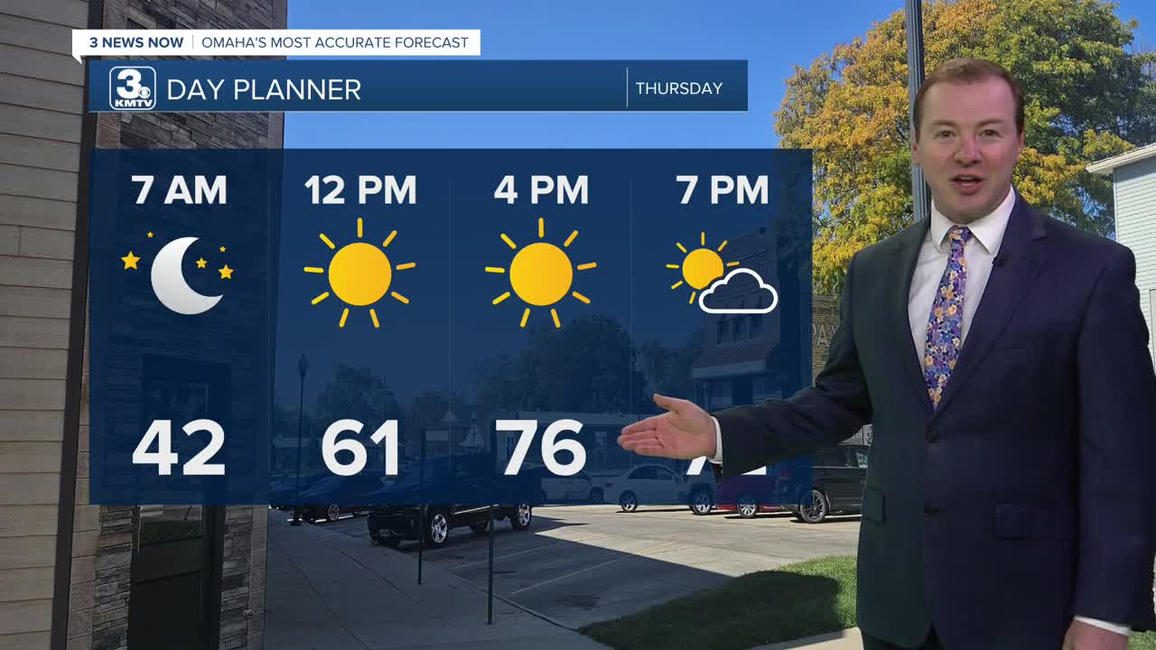
It will be a milder night with clear skies and temps in the low 40s for Thursday morning.
Thursday will be even warmer with highs in the upper 70s. A few neighborhoods may reach the 80s across eastern Nebraska!
Record highs are looking likely on both Friday and Saturday with 80s for highs and lots of sunshine. We may reach 90 on Saturday.
The second half of this weekend looks cooler, and breezy with highs dropping in the 60s by Sunday. As of now, no rain comes from this cool-down.
Next week continue the dry, milder pattern into next week, starting in the 50s/60s on Monday and Tuesday. Rain looks very limited over the next 7 days, but we may see some rain by the end of next week.
WEDNESDAY NIGHT
Mostly Clear
Mild
Low: 42
Wind: W 5-15
THURSDAY
Mostly Sunny
Above-Average Temps
High: 79
Wind: W 10-15
FRIDAY
Mostly Sunny
Record Highs
High: 84
Wind: W 10-15
Share your weather pictures with KMTV:
- Email to News@3newsnow.com
- 3 News Now Facebook page
- Use the hashtag #3NewsNow on Instagram or X (formerly Twitter)
