

3 THINGS TO KNOW:
- Clouds & dense fog to keep the holidays a bit colder
- Bank to near 60º on Friday
- Mostly dry until after this weekend
FORECAST:
Clouds will move in Tuesday night, keeping things a little warmer overnight. There could be a little patchy fog and spotty drizzle as we head into Wednesday morning with temps in the upper 30s.
Wednesday will be a cloudy day, with spotty drizzle in the morning. Thanks to the clouds, Christmas Eve temperatures will be in the lower 50s.
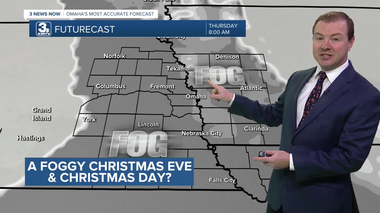
Dense fog will develop around the region heading into Wednesday night, reducing visibility on roads to less than 1/4 of a mile through Thursday morning.
Christmas Day will be a cloudy and foggy day, but still warm for this time of year, reaching the upper 40s Thursday afternoon. More patchy fog may develop Thursday night.
Sunshine will be back on Friday, with highs in the upper 50s to near 60 degrees.
Cold, winter air returns this weekend. Saturday will be partly sunny, breezy, and still mild for a few hours, in the mid to upper 50s.
A strong cold front will arrives Saturday night, kicking up a gusty north wind and sending temps down in the low 30s on Sunday. No rain or snow is expected from this cold front.
New Years week appears to remain dry across the Omaha region, with highs closer to average, near 40 through New Years Day.
TUESDAY NIGHT
Increasing Clouds
Chilly
Low: 37
Wind: NW 5-10
CHRISTMAS EVE
Mostly Cloudy
Foggy with Drizzle
High: 52
Wind: S 5-10
WEDNESDAY NIGHT
Mostly Cloudy
Dense Fog
Low: 39
Wind: S 3-6
CHRISTMAS
Cloudy
Foggy with Drizzle
High: 49
Wind: SE 5-10
Share your weather pictures with KMTV:
- Email to News@3newsnow.com
- 3 News Now Facebook page
- Use the hashtag #3NewsNow on Instagram or X (formerly Twitter)
