

3 THINGS TO KNOW
- Staying frigid through Monday morning
- Light snow Friday night into Saturday
- Warmer, but seasonally cold next week
FORECAST
It will be dangerously cold outside over the next few days. Morning temperatures will be below 0 through Monday morning, with a wind chill as low as -30 at times. You can get frostbite in as little as 30 minutes in this air. Limit the time outdoors if you are able, keep pets indoor, and check on more vulnerable loved ones.
Clouds will move into the region Friday evening, and eventually some spotty snow showers move in after midnight.

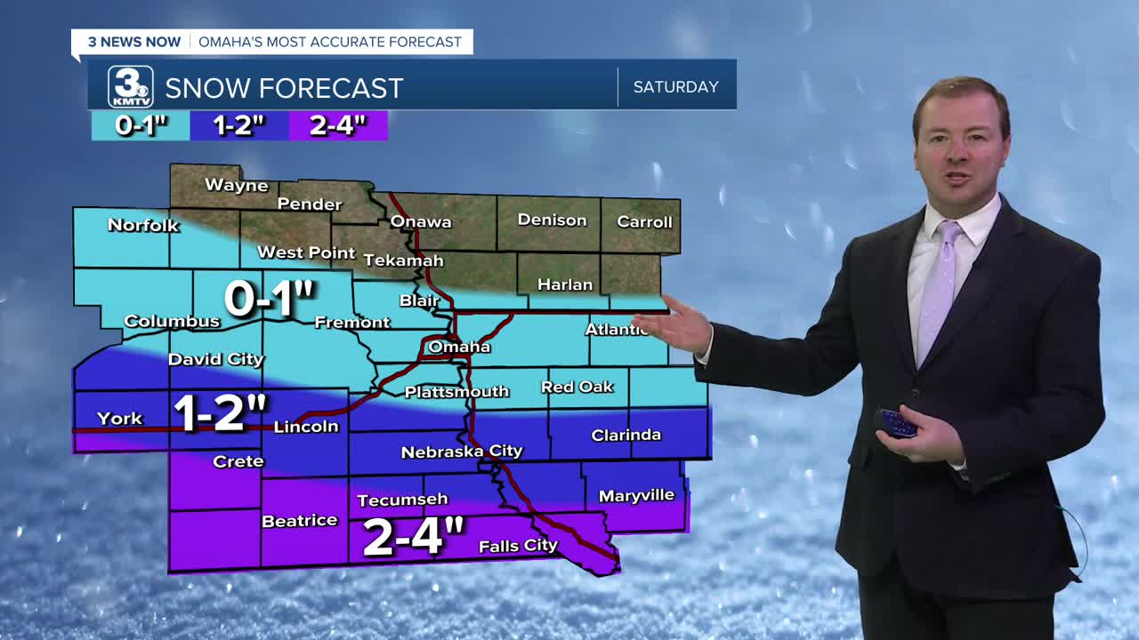
This spotty snow will become more scattered by Saturday morning, leaving some small snow accumulations of 1" around the Omaha metro. To our south, snow amounts may reach 2-4" closer to the Kansas/Nebraska border.
This will be powdery snow. So some snow drifts are possible, but winds are not expected to be stronger than 20mph.
Saturday will be frigid, near 4 degrees, dropping to near -3 by Sunday morning.
Sunshine does return to our skies on Sunday, and it will be just a little warmer out, in the low 10s. Due to the clear sky, lows will again dip to around -4 by Monday morning.
It may be a little windy heading into Monday morning. Combined with an air temperature of -4, Monday morning wind chills could reach -20 to -35.
Things will begin to warm up next week. Monday will be mostly sunny, in the 20s. We reach the upper 20s on Tuesday and Wednesday. We should be near the 30s again by next weekend.
FRIDAY NIGHT
Cloudy
Snow Moves In
Low: -2
Wind: NE 5-10
SATURDAY
Cloudy
Morning Snow
High: 4
Wind: E 5-15
SUNDAY
Partly Cloudy
Very Cold
High: 12
Wind: NW 5-10
Share your weather pictures with KMTV:
- Email to News@3newsnow.com
- 3 News Now Facebook page
- Use the hashtag #3NewsNow on Instagram or X (formerly Twitter)
