

WHAT TO KNOW:
- A brisk start to Thursday morning, below zero
- Chance at light snow Saturday
- A warming trend for next week
FORECAST:
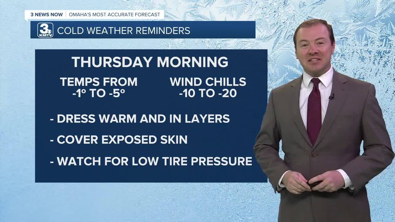
Frigid, arctic air begins to settle into the region later tonight, and it may be our first night below zero in many Omaha neighborhoods. Lows will be around 1 to -5 F Thursday morning, with wind chills as cold as -10 to -20. The wind is expected to become fairly light by the morning.
Thursday will be sunny, but cold, with highs in the lower 20s. We'll hold in the upper 10s for Thursday night.
We slowly climb out of the bitter cold by the end of the week. Friday will be partly sunny with highs in the low to mid 30s.
A 'clipper' system will roll through the region Saturday, bringing with it a chance at light snow and another quick shot of cold air. There is uncertainty on location, and timing this snow. Amounts are uncertain at this time, too. But these types of systems usually bring less than 3" of snow and it is usually a narrow band of heavier snow, with lesser, widespread amounts of snow.
Right now, it looks like some light snow will move in Saturday afternoon through late evening, with up to 1" possible around far east Nebraska and across all of west Iowa. Isolated amounts could reach 2" of snow by Saturday night.
By Sunday, it will be partly sunny and cooler, in the low 20s.
A warming trend is expected next week, and temperatures will be at, or above average. What does this mean? Days generally in the 30s and 40s. More importantly, highs above freezing.
Monday will be mostly sunny, in the mid 30s. Tuesday will be even warmer with low 40s. We do cool off a little next Wednesday and Thursday, but highs are expected to remain in the mid 30s, above freezing.
WEDNESDAY NIGHT
Mostly Clear
Very Cold
Low: -2
Wind: N 5-15
THURSDAY
Mostly Sunny
Cold
High: 21
Wind: NE 5-10
THURSDAY NIGHT
Mostly Clear
Steady Temps
Low: 19
Wind: S 5-15
FRIDAY
Mostly Sunny
Not as Cold
High: 34
Wind: SW 5-10
Share your weather pictures with KMTV:
- Email to News@3newsnow.com
- 3 News Now Facebook page
- Use the hashtag #3NewsNow on Instagram or X (formerly Twitter)
