

3 THINGS TO KNOW:
- Strong winds expected Tuesday night
- More cold air this weekend
- Chance at light snow Friday night
FORECAST:
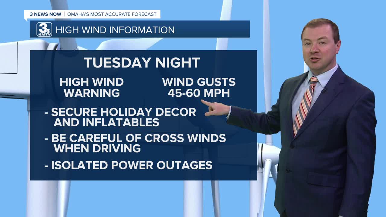
A high wind warning is in effect for Tuesday night around Omaha, where the wind gust potential will be around 50-60mph north of Omaha, and 45-55mph south of Omaha. Isolated power outages are possible overnight due to the wind. Also, make sure to secure you holiday decorations.
By Wednesday morning it will still be windy out, and a little colder in the low 30s, where temperatures will stay steady for the day under mostly cloudy skies. We could see some snow flurries in the morning, too. By Wednesday evening, the winds should become calmer.
Thursday will remain mostly cloudy with highs in the mid 30s.
Another cold front will reach Omaha on Friday, sending in more arctic air for the weekend. Friday will be windy and cloudy with highs in the mid 20s.
There is a small chance at light snow Friday night into Saturday morning. Specific details on locations and amounts are uncertain, but some minor accumulation are possible around and north of Omaha heading into Saturday morning.
The weekend will be cold! Highs on Saturday will be near 20. We're down in the single digits Saturday night. By Sunday, we are mostly sunny and back in the mid 20s.
Warmer weather will slowly return early next week, and Omaha's high temperature will get closer to normal, now around 39 degrees.
TUESDAY NIGHT
Mostly Cloudy
Windy
Low: 28
Wind: NW 45-60
WEDNESDAY
Mostly Cloudy
AM Flurries
Colder and Windy
High: 33
Wind: NW 20-30
WEDNESDAY NIGHT
Mostly Cloudy
Snow Flurries
Low: 22
Wind: N 5-15
THURSDAY
Cloudy
Small Snow Chance
High: 37
Wind: N 5-15
Share your weather pictures with KMTV:
- Email to News@3newsnow.com
- 3 News Now Facebook page
- Use the hashtag #3NewsNow on Instagram or X (formerly Twitter)
