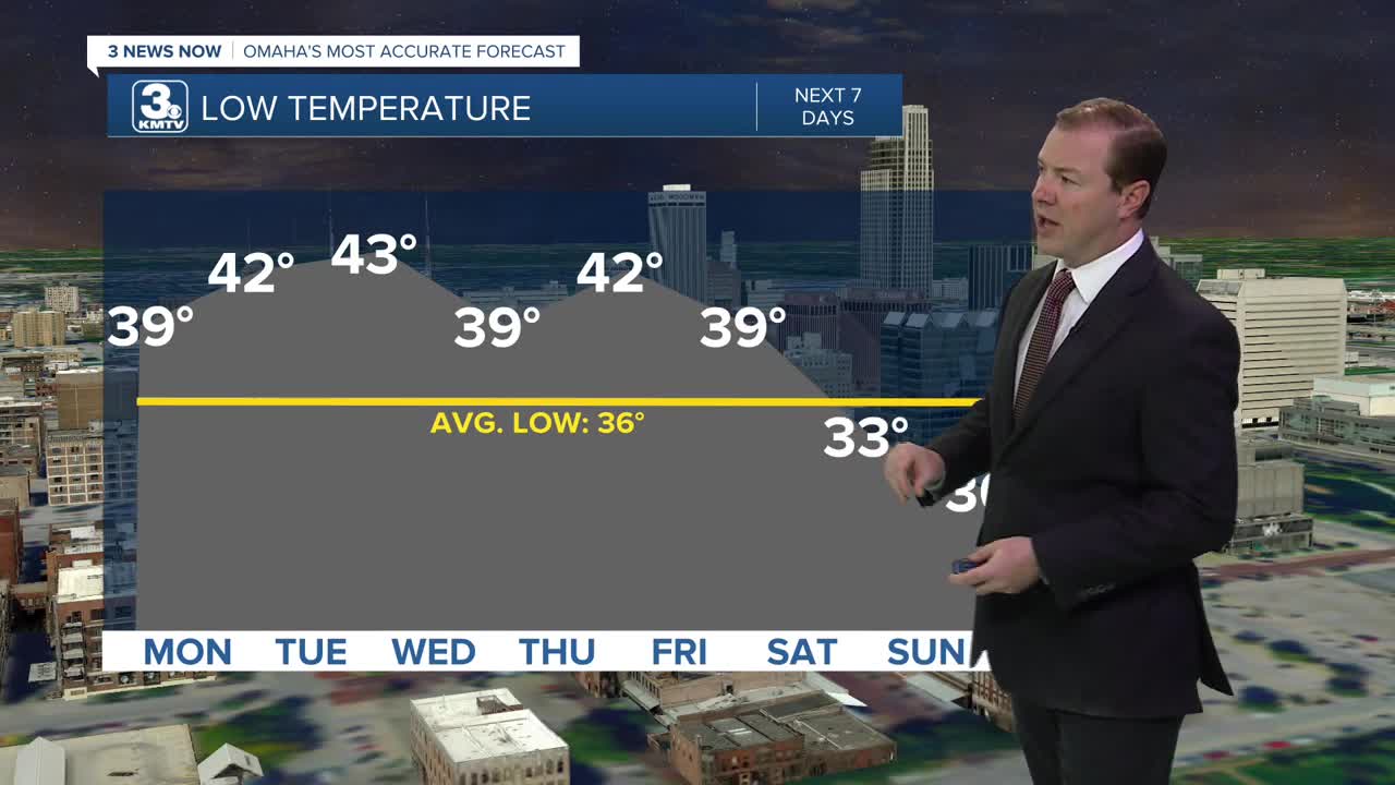


The wind stays a little breezy Sunday night, keeping things a little warmer out overnight. Generally, it will be a few days until we get to near freezing (32 degrees) at night. Skies will stay clear with lows near 40 degrees for Monday morning.

Monday will be sunny and less windy with highs in the low 60s.
Tuesday will be our warmest day of the week, with highs in the upper 60s across much of our viewing area! There may even be a few neighborhoods west of Omaha that reach 70 in the afternoon.
A cold front will arrive Tuesday night, but it does not bring any measurable rain. So, we likely stay dry for a few more days.
We cool off a little for Wednesday, into the upper 50s and low 60s with sunshine.
The wind will become breezy towards the end the week, and we'll start to see more clouds than sun for Thursday and Friday. Both days will be in the mid 60s in the afternoon.
Cooler air will begin to move towards the region this coming weekend, and it could come with a small chance at rain. Less than 1/4th of us would see any measurable rain on Saturday with highs in 50s, dipping into the upper 40s by next Sunday. This is also when we would probably cool to below freezing as well.
SUNDAY NIGHT
Mostly Clear
Not As Cold
Low: 39
MONDAY
Mostly Sunny
Warmer
Less Windy
High: 63
TUESDAY
Mostly Sunny
Mild
High: 69
Share your weather pictures with KMTV:
- Email to News@3newsnow.com
- 3 News Now Facebook page
- Use the hashtag #3NewsNow on Instagram or X (formerly Twitter)
