

3 THINGS TO KNOW
- Cold air begins its move-in Thursday
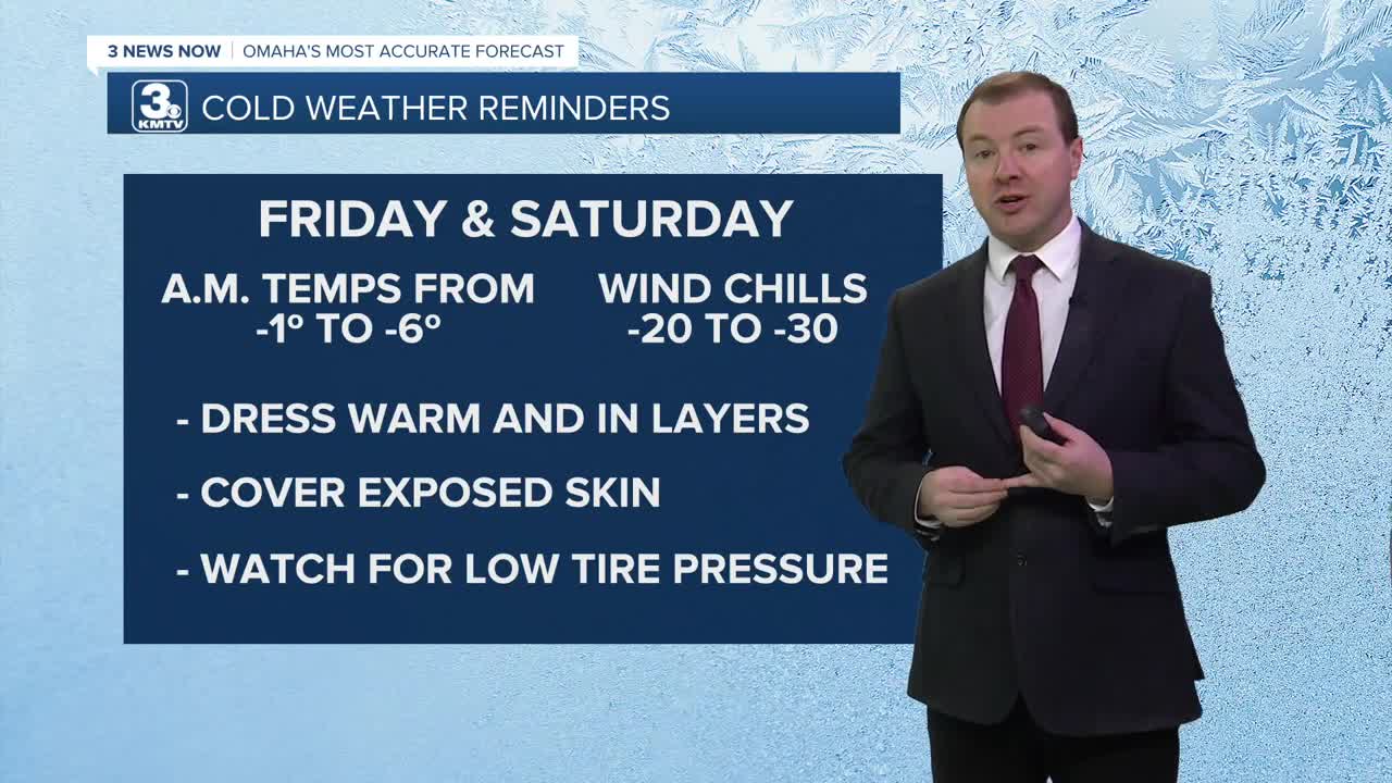
- Dangerous cold Friday, Saturday
- A chance for snow early this weekend
FORECAST
The wind will begin to settle down this evening and by Wednesday night, it's cold again with lows in the mid-10s.
Thursday will be partly sunny, cooler, and breezy with highs in the low 30s. Colder, arctic air will begin to move into the region starting Thursday evening.
Even colder air will move into the region by the end of the week, and it will become dangerous on Friday. Temperatures will dip below zero Friday morning, with wind chills around -30 to -20. The wind will not be overly strong, it's just THAT COLD!
You could get frostbite in as little as 30 minutes in this kind of air, so limit skin to outdoor exposure. Bring pets inside, and check on our more vulnerable neighbors.
Friday is the coldest day with a high of around 4. Friday night will drop below 0 once again.
There is a chance we could see a few snow showers Friday night and Saturday. The trends in the storm is moving it a bit north, meaning some spots south of I-80 may see light snow. Areas south of Omaha may only get a dusting of snow. However, a strong high-pressure system moving in from Canada may reach us first, leaving the Omaha region just cold and dry. Those that live south of Omaha could get 1-3" of snow.
The rest of the weekend will be frigid and dangerously cold at night as morning temps will be below zero.
By next week, temperatures will start to recover, reaching the 20s on Monday and the 30s by Tuesday.
WEDNESDAY NIGHT
Partly Cloudy
Cold
Low: 15
Wind: SW 5-15
THURSDAY
Partly Cloudy
Seasonal
High: 30
Wind: NW 10-25
FRIDAY
Cloudy
Frigid
High: 4
Wind: N 10-20
Share your weather pictures with KMTV:
- Email to News@3newsnow.com
- 3 News Now Facebook page
- Use the hashtag #3NewsNow on Instagram or X (formerly Twitter)
