
3 THINGS TO KNOW
- Mild Monday
- Very small, short lived chance for overnight precip
- Warmer to end the week!
FORECAST
Groundhog day is marked with some mild temperatures, with highs just reaching the lower 40s and some hefty cloud coverage. While Punxsutawney Phil predicted six more weeks of winter, this week won't feel like it.
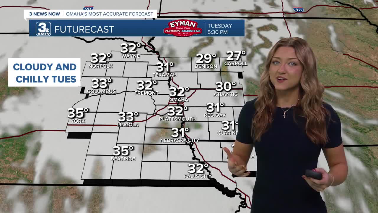
We are mostly cloudy to begin the workweek, but no significant cooldown is in sight. Tuesday is expected to be our coldest day of the week - relatively speaking - with highs tapping out in the mid 30s.
Temperatures jump on Thursday with more sunshine, with many neighborhoods reaching the 40s and 50s! Friday stays warm, in the mid-40s, and it's breezy.
Any chance for precip holds off until sometime next week, at the earliest.
SUNDAY
Mostly Cloudy
Warmer
High: 41
Wind: NW 5-15
SUNDAY NIGHT
Mostly Cloudy
Not As Cold
Low: 22
Wind: N 5-10
MONDAY
Mostly Cloudy
Seasonal
High: 38
Wind: E 5-10
TUESDAY
Mostly Cloudy
Seasonal
High: 34
Wind: NE 5-10
Share your weather pictures with KMTV:
- Email to News@3newsnow.com
- 3 News Now Facebook page
- Use the hashtag #3NewsNow on Instagram or X (formerly Twitter)
