

3 THINGS TO KNOW
- Spotty rain Saturday evening
- More storms on Sunday, could be severe
- Wet Monday, but next week looks drier
FORECAST
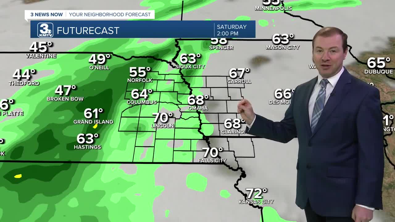
There may be more chances at rain over the weekend. Saturday starts mostly dry with only a few spotty showers near Columbus, followed by afternoon clouds and highs near 70. Rain showers will move in from the west of Omaha later in the afternoon and heading into Saturday evening. Plan for there to be some rain in town for any of your outdoor evening plans.
The rain continues off/on into Saturday night, Sunday morning and afternoon, but there should be some dry-time mixed in, too. It will be a cloudy and breezy Sunday with highs in the upper 60s.
Heading into Sunday evening, storms will move in from Kansas, and could be severe with damaging winds and very large hail across southeastern Nebraska, up to Omaha and Lincoln through midnight. Overnight, pockets of heavy rain and hail will continue into Monday morning.
Some very heavy rain may fall Sunday night, with amounts of 1-3" of rainfall possible, which could lead to flash flooding in southeast Nebraska and southwest Iowa.
We'll be watching for another round of stronger storms early Morning through midday as a cold front sweeps the weather eastward into central Iowa. By Monday afternoon, it's drier and windy with highs in the 60s.
The rest of next week is now looking drier and cooler. The average high for late April is around 70 degrees, and we will be cooler than that and closer to the low 60s all of next week. For now, it looks like the coldest nightly temps will be in the upper 30s (above freezing) late next week
SATURDAY
Mostly Cloudy
Evening Rain
High: 70
Wind: SE 5-15
SATURDAY NIGHT
Mostly Cloudy
Spotty Rain
Low: 52
Wind: E 5-15
SUNDAY
Scattered Storms
Breezy
High: 69
Wind: SE 15-25
MONDAY
Scattered Storms
Breezy
High: 7
Wind: SE to NW 15-25
Share your weather pictures with KMTV:
- Email to News@3newsnow.com
- 3 News Now Facebook page
- Use the hashtag #3NewsNow on Instagram or X (formerly Twitter)
