

3 Things to Know
- More spotty rain tonight, Thursday
- Somewhat humid Friday & Saturday
- Severe heat and humidity return starting Sunday
Forecast
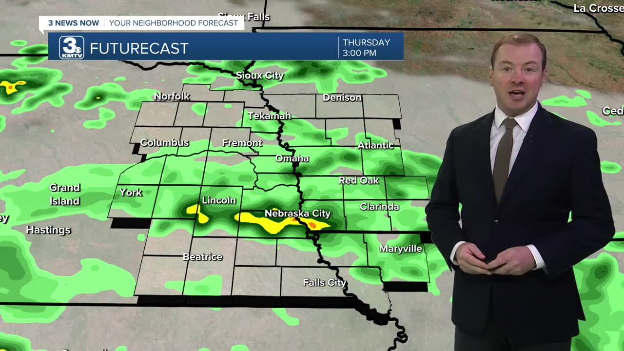
Heading into late Wednesday night, another round of rain will move into the region. The heaviest pockets of rain will stay south of Omaha and Lincoln, where parts of southeast Nebraska could see some gusty winds. This rain will continue into Thursday morning.
Thursday will be a mostly cloudy day with spotty rain showers. Because of the clouds and chance at rain, temps will only reach the upper 70s. Rain will exit the region Thursday night.
Friday is now trending drier and sunnier, which also means it will be a little warmer out with low 80s for highs.
Warm, humid air will be gin to blow into the region Saturday. This could lead to a few spotty showers and storms throughout the day. It will be wind and muggy Saturday with highs in the upper 80s, feeling more like the mid 90s.
Severe heat and humidity kick into full gear Sunday. It will be sunny and breezy with highs in the low 90s and a heat index around 105+.
This severe heat will continue through much of next week with highs Monday-Wednesday in the low to mid 90s and heat indices around 100-105.
Heading into the 4th of July weekend, it will still be very warm with low 90s for highs, but the humidity may be slightly less oppressive. There are some signals for rain and storms as the summer heat ridge in the jet stream eventually begins to break down around the 4th-7th.
This heat relief may be several days away, but should arrive some time after the 4th of July weekend is over.
WEDNESDAY NIGHT
Mostly Cloudy
Spotty Storms
Low: 63
Wind: NW 5-10
THURSDAY
Mostly Cloudy
Spotty Storms
High: 78
Wind: S 5-10
- Email to News@3newsnow.com
- 3 News Now Facebook page
- Use the hashtag #3NewsNow on Instagram or X (formerly Twitter)
