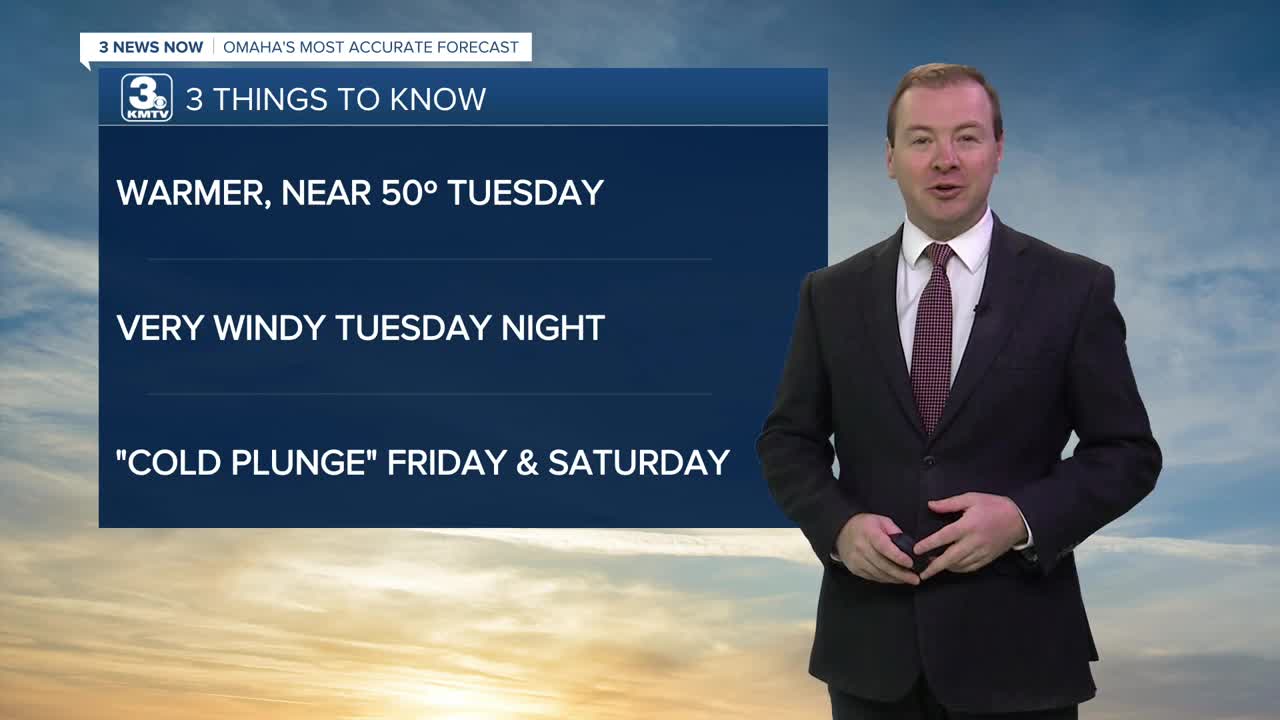


3 THINGS TO KNOW:
- Briefly back in the 40s Tuesday
- Avery windy Tuesday night
- Another snap of cold air hits Friday, this weekend
FORECAST:
Clouds will stick around for the rest of this evening and tonight. It will not be as frigid overnight as recent nights, with lows in the upper 20s.
Tuesday will be the warmest day of the week with a mix of sun and clouds with highs in the upper 40s. A few neighborhoods in Nebraska may even reach 50 degrees if there is enough sunshine! There should be a lot of snow melting Tuesday.
We have added a small chance for rain Tuesday evening as a cold front brings to approach Omaha. The winds will become very gusty Tuesday night, out from the north at 30-50 mph. Make sure you secure any outdoor holiday decor before the wind arrives.
By Wednesday morning, it will be a little colder out, in the low 30s, where temperatures will stay steady for the day under mostly cloudy skies.
Thursday will remain mostly cloudy with highs in the low 30s.
The cool-down doesn't stop there. We get another blast of cold air on Friday, sending temperatures down in the low 20s for Friday afternoon, and into the upper 10s for Saturday. Overnight temperatures dip in the single digits this weekend
Each day Wednesday through Saturday could bring some small snow chances, but no major impacts, or accumulations are expected.
Warmer weather will return early next week, and Omaha's high temperature will get closer to normal, now around 39 degrees.
TUESDAY
Partly Sunny
Warmer than average
High: 50
Wind: SW 10-25
TUESDAY NIGHT
Mostly Cloudy
Windy
Low: 28
Wind: NW 30-50
WEDNESDAY
Mostly Cloudy
Colder and Windy
High: 33
Wind: NW 20-30
THURSDAY
Mostly Cloudy
Less Windy
High: 32
Wind: N 5-15
Share your weather pictures with KMTV:
- Email to News@3newsnow.com
- 3 News Now Facebook page
- Use the hashtag #3NewsNow on Instagram or X (formerly Twitter)
