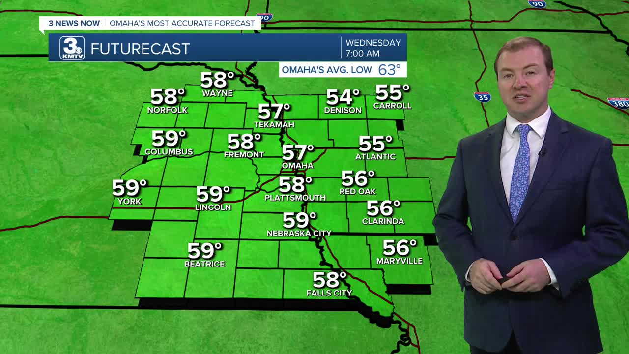


Skies will remain partly cloudy tonight. While not as cool overnight as recent nights this week, we still manage to dip into the mid to upper 50s for Wednesday morning.
The wind will be a little stronger out of the south Wednesday afternoon, helping to blow in some slightly warmer weather. Highs will be near 80 with more clouds than sunshine. While a few sprinkles may be possible during the day and at night, no measurable rain is expected.
Thursday brings a little more humidity, but it won't be bad for August. Highs will be in the low 80s with a mix of sun and clouds.
We stay near 80 Friday with a few clouds. A couple spotty showers are possible, but most of us will be dry.
Rain will become possible over the weekend. The best place to see any weekend rain will be west of Omaha, mainly in central to east-central Nebraska. There will be a large number of spots in eastern Nebraska and especially western Iowa that stay dry all weekend. This will keep more clouds around and helps to keep the heat under control. Highs will be in the upper 70s to near 80 both afternoons, and nightly temperatures will be around 60 degrees.
Monday will be dry for most of us with upper 70s and some sunshine.
Another chance at rain will be possible Tuesday. But, for now we'll keep the chance low with highs in the low 80s and partly cloudy skies.
WEDNESDAY
Partly Cloudy
Warmer
High: 80
WEDNESDAY NIGHT
Partly Cloudy
Comfy
Low: 59
THURSDAY
Partly Cloudy
More Humidity
High: 81
FRIDAY
Partly Cloudy
Isolated Showers
High: 81
Share your weather pictures with KMTV:
- Email to News@3newsnow.com
- 3 News Now Facebook page
- Use the hashtag #3NewsNow on Instagram or X (formerly Twitter)
