

WHAT TO KNOW:
- First accumulating snow this season on Saturday
- Travel impacts likely
- Very cold air behind the snow
- Light snow south of Omaha on Monday
FORECAST:
Snowfall number are expected to be on the lower end of our forecast range for our Omaha neighborhoods, so we have slightly adjusted, and lowered expected snowfall amounts for Saturday.
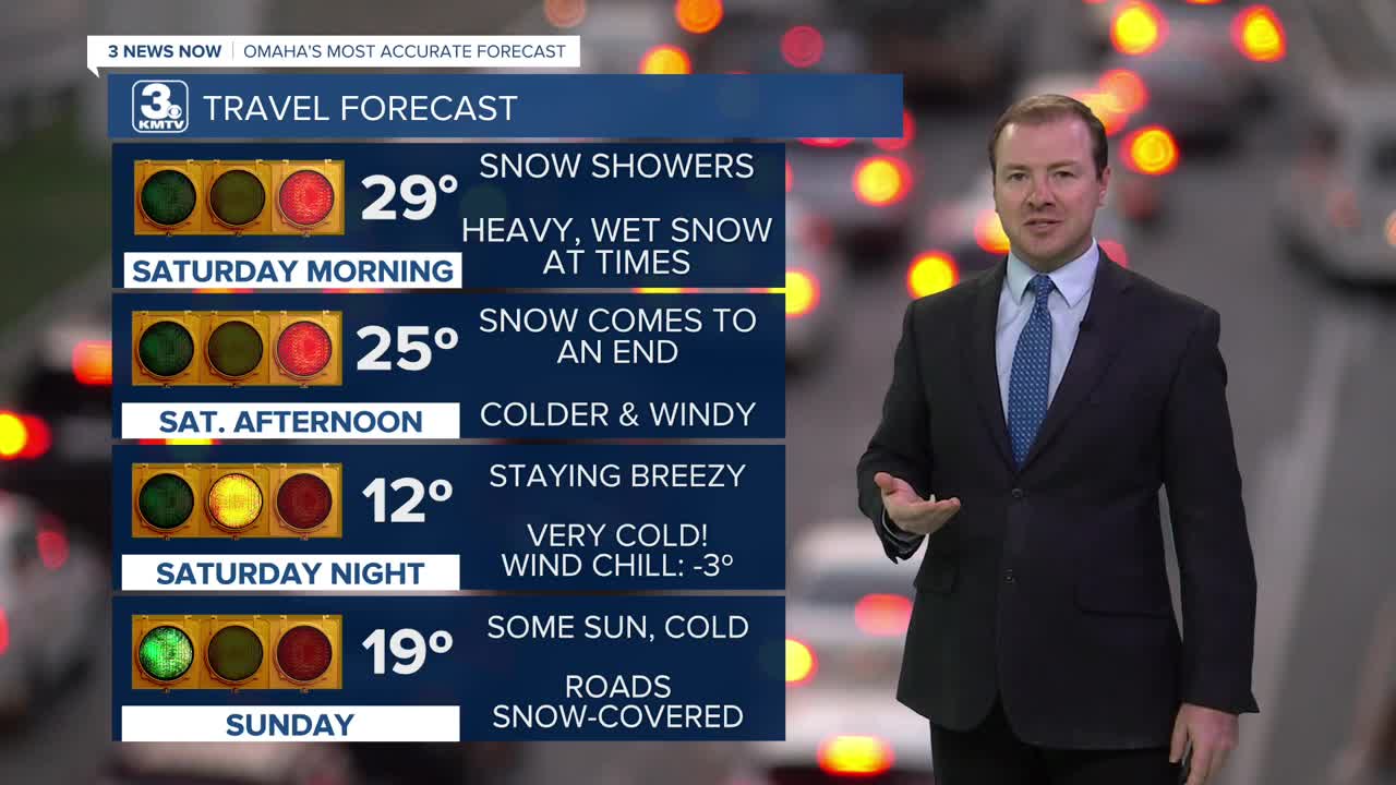
Snow showers will continue for the morning until around noon, slowly tapering off in the afternoon. The morning is when we expect the bulk of our snow accumulations.
A few pockets of snow flurries and light snow showers will remain possible Saturday evening, but accumulations are generally not expected.
It will be windy at times as the snow exits, creating blowing snow conditions.
Amounts:
The lowest totals will be across southeast NE, with less than 3" expected. This is also where we expect there to be some minor ice accumulation due to a mixture of freezing rain/sleet. The Omaha metro is in the 3-6" range. In western Iowa, neighborhoods could see up to 6-9".

Travel issues are expected through Saturday night, with the worst of it on Saturday morning and afternoon. IF you do need to travel, plan for extra time to get where you need to go. Roads will have more snow coverage in Iowa than in Nebraska. The wind will be gusty on Saturday as well, which may blow the snow around and reduce visibility.
The cold air associated with this pattern arrives on Sunday, and temperatures drop into the low 20s on Sunday and Monday afternoon. Temperatures at night will dip to near or below 10 degrees.
There is another chance of light snow south of Omaha, closer to the Nebraska/Kansas border, on Monday. At this time, this is not as impactful as the weekend.
Warmer days in the 30s/40s will return towards the end of next week, into next weekend.
SATURDAY
Cloudy
Wintry Mix to Snow
High: 29
Wind: NW 15-25 G 35
SATURDAY NIGHT
Mostly Cloudy
Windy
Low: 12
Wind: NW 20-25
SUNDAY
Mostly Cloudy
Very Cold
High: 19
Wind: NW 5-15
Share your weather pictures with KMTV:
- Email to News@3newsnow.com
- 3 News Now Facebook page
- Use the hashtag #3NewsNow on Instagram or X (formerly Twitter)
