

There may be a few foggy areas again in the morning, but it won't be a common problem. We'll start the morning in the mid 60s.
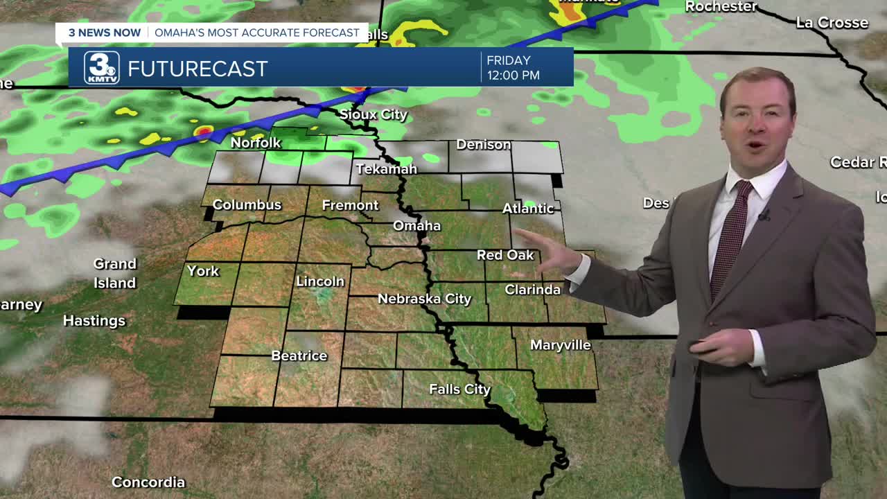
Friday will start with a lot of sunshine, followed by clouds in the afternoon as our next cold front begins to move in from the northwest. Omaha and neighborhoods farther southeast will likely be in the upper 80s, but the clouds could keep things in the lower 80s over northeast Nebraska and western Iowa.
Hit and miss storms could get to northeast Nebraska late Friday afternoon as the cold front arrives from our north, and they will be closer to I-80 around the evening commute. As we head later into the evening, more of the storms will be southeast of Omaha, and most of the rain will be out of our area by 2 in the morning.
One or two of these storms may get strong enough to produce damaging wind gusts, or pockets of large hail.
Behind the cold front, much cooler and less humid weather will move in for the weekend. Saturday will be partly cloudy with highs near 80. The humidity will be falling through the day. There could be a couple spotty showers, mainly west of Omaha.
We keep the small chance for rain Sunday, but most of us will be dry. The humidity finally drops to comfortable levels, making our mid 70s feel extra nice!
Thanks to the lower humidity early next week, our mornings will be able to cool off into the 50s in Omaha! Neighborhoods farther north and into southwest Iowa could even wake up to 40s.
Monday and Tuesday afternoons will be mostly sunny with mid 70s.
We start to warm up a little heading into Wednesday, with upper 70s and a lot of sunshine.
FRIDAY
Partly Cloudy
Scattered P.M. Storms
High: 89
FRIDAY NIGHT
Partly Cloudy
Spotty Storms
Low: 65
SATURDAY
Partly Cloudy
Isolated Rain
High: 80
SUNDAY
Partly Cloudy
Isolated Rain
High: 75
Share your weather pictures with KMTV:
- Email to News@3newsnow.com
- 3 News Now Facebook page
- Use the hashtag #3NewsNow on Instagram or X (formerly Twitter)
