

3 THINGS TO KNOW
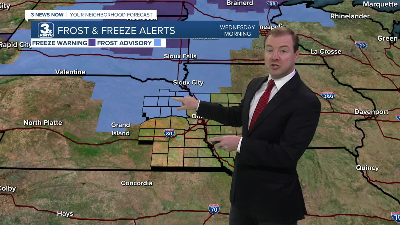
- Patchy frost northwest of Omaha Tuesday night
- Next rain chance comes Thursday/Friday
- Warmer this upcoming weekend
FORECAST
Clouds will gradually clear out of the region tonight and it gets cold, near record lows! Temperatures for Tuesday night will dip into the upper 30s to low 40s. There could be a few areas of patchy frost in northeast Nebraska. The Omaha metro will likely NOT see frost. Omaha's record low for Wednesday, 5/20 is 37 degrees.
Wednesday starts cool and sunny, followed by clouds into the afternoon. Highs will reach the low 60s with calmer east winds.
Rain returns to the region Thursday and Friday, and we could see another 0.25" to 0.75" rainfall. Areas in NW Missouri to SW Iowa could see an inch of rain, adding to your already soggy farm fields. Thursday will likely have quite a bit of dry-time, but Friday is now looking likely a pretty wet day wit ha few non-severe thunderstorms mixing in. This rain should clear out by Saturday morning.
The upcoming Memorial Day weekend looks sunnier, warmer with temperatures climbing back into the 70s by Saturday and 80s by Sunday. Monday is Memorial Day and it looks sunny with highs in the mid 80s.
TUESDAY NIGHT
A few Clouds
Patchy Frost Possible
Low: 40
Wind: N 5-15
WEDNESDAY
Partly Cloudy
Cool
High: 62
Wind: NE 5-15
WEDNESDAY
Mostly Cloudy
Isolated Rain
Low: 47
Wind: E 5-15
Share your weather pictures with KMTV:
- Email to News@3newsnow.com
- 3 News Now Facebook page
- Use the hashtag #3NewsNow on Instagram or X (formerly Twitter)
