
3 THINGS TO KNOW
- Pleasant Valentine's Day evening!
- Temperatures on the rise into early week
- More active pattern later next week
FORECAST
Lots of us were lucky to see some lower 60s this afternoon, making for a very pleasant Valentine's Day! To add to that, majority of that precipitation looked to stick to the south of Omaha.
Tonight temperatures look to hover just slightly above freezing tonight, majority of the area seeing the mid 30s with some spotty upper level clouds.
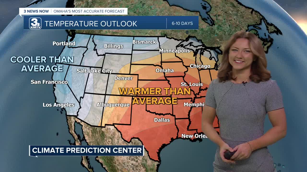
Unfortunately for much of Nebraska, the dry conditions continue. Another ridge makes its way into the Southern Plains, which basically keeps us drier and warmer than average.
Expect more sunshine for your Sunday, with highs peaking around the mid to upper 60s.
There is a fire danger risk for Sunday, as well as next Tuesday and Wednesday. Our relative humidity values for these days are pathetic, with values in the teens and twenties. Pair that with the warmth and chance for stronger wind gusts next week, and that puts us in a high fire danger risk.
The record temp set for Monday was 67, set in 2017, and that's exactly what our high is expected for. We don't stop climbing there though, with Tuesday's highs expected to be in the lower 70s.
The first of a couple of storm systems passes by Tuesday evening, bringing a rain shower or two, though most will be dry.
Wednesday stays warm, in the low 60s.
A second, bigger system may impact us on Thursday with another small rain chance. What may be more impactful, however, is an end to the well-above-average weather by late next week.
SATURDAY NIGHT
Partly Cloudy
Not As Cold
Low: 34
Wind: SE 5-10
SUNDAY
Mostly Sunny
Warm
High: 66
Wind: S 5-10
MONDAY
Mostly Sunny
Warm
High: 67
Wind: S 5-10
Share your weather pictures with KMTV:
- Email to News@3newsnow.com
- 3 News Now Facebook page
- Use the hashtag #3NewsNow on Instagram or X (formerly Twitter)
