

3 Things to Know
- Strong storms possible Friday evening
- Warm, humid with more rain this weekend
- Next week looks HOT...
Forecast
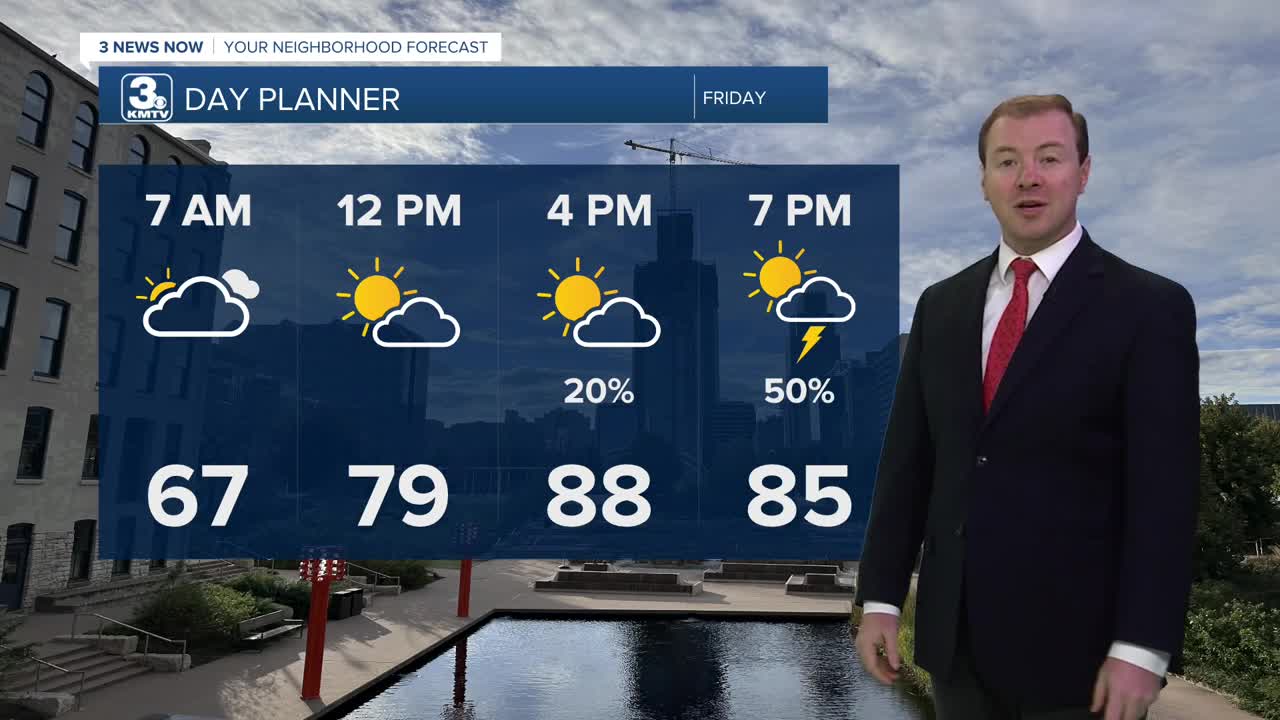
Friday looks hot and humid before the next round of storms arrive. It will be a partly to mostly sunny day with highs in the upper 80s, feeling more like 95 in the afternoon.
After 7-8pm, storms will begin to develop along I-80, and will slowly drift south into southeast Nebraska and southwest Iowa throughout the night. Severe weather is possible, with pockets of very large hail up to the size of a baseball, and damaging winds stronger than 70mph. A tornado may also be possible. This rain will also fall over areas that received around2-4" of rain from Thursday's storms, so flooding may be possible, too. Storms will exit the region after midnight.
We should get a break in the rain activity Saturday, but not from the heat! Saturday will be very warm with highs near 90. There is a small chance at some rain Saturday evening.
Sunday starts mostly dry and humid, but we expect a round of storms to move after 9-10 AM, which would continue for the rest of the day and into Monday. Severe weather is not expected, but we could see some heavier pockets of rain.
After Monday, it will start to get hot! Assuming it does not rain on Tuesday, temps will reach the low 90s. Omaha is likely in the 90s for daytime highs from Wednesday-Friday with heat indices around 100-105.
THURSDAY NIGHT
Partly Cloudy
Rain Exits
Low: 67
Wind: SE 5-15
FRIDAY
Partly Sunny
Strong Evening Storms
High: 89
Wind: SE 15-25
SATURDAY
Partly Sunny
Warm & Humid
High: 90
Wind: SE 15-25
Share your weather pictures with KMTV:
- Email to News@3newsnow.com
- 3 News Now Facebook page
- Use the hashtag #3NewsNow on Instagram or X (formerly Twitter)
