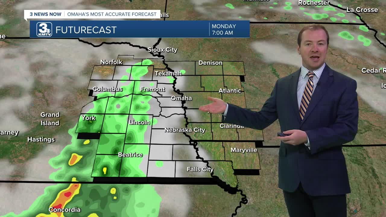


Clouds will be on the increase tonight as a warm front moves into the region. This will kick off scattered rain and thundershowers after 4 am, and through the Monday morning commute. Not everyone will see rain, but those that do could get a brief heavy downpour. We'll start the morning in the upper 50s.
Once the morning rain clears up around noon, Monday afternoon will become warmer and breezy with highs in the upper 70s and partly cloudy skies. While there may be an isolated evening rain shower, most of us will be dry for the evening.
Overnight, another round of rain will be possible just before the start of Tuesday morning. It will be a lot warmer out than recent morning, with low 60s to begin the day.
Tuesday will then be mostly sunny with low 80s, followed by mid 80s on Wednesday.
The sunshine continues into Thursday with highs in the mid 80s.
Even warmer air will begin to move into the region, pushing afternoon temperatures on Friday and Saturday into the upper 80s with breezy winds. There may be a few rain showers around, but we'll keep the chance low for now.
By Sunday, clouds and and eventually some rain will move into the region, dropping temperatures down into the low 80s for the end of the weekend.
SUNDAY NIGHT
Partly Cloudy
Spotty Rain After 4 AM
Low: 56
MONDAY
Partly Cloudy
Spotty Showers
Breezy
High: 78
MONDAY NIGHT
Partly Cloudy
Slight Rain Chance
Low: 62
TUESDAY
Partly Cloudy
Seasonal
High: 81
WEDNESDAY
Mostly Sunny
Warm
High: 84
Share your weather pictures with KMTV:
- Email to News@3newsnow.com
- 3 News Now Facebook page
- Use the hashtag #3NewsNow on Instagram or X (formerly Twitter)
