
3 THINGS TO KNOW
- Temps gradually incline through the weekend
- Rain chances Saturday morning
- Record threatening highs early next week
FORECAST
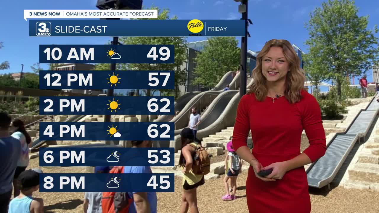
While spring isn't for at least another 30 days, our temperatures really want to challenge that! Our Friday looks comfortable, with temperatures reaching 60 and some spotty clouds throughout the afternoon.
While most of us will stay dry on Valentine's Day, a storm system may bring some rain to neighborhoods south of I-80. It's not expected to be a washout, but check the radar before heading outdoors. In Omaha, odds are the city remains dry.
With the sunshine returning on Sunday, we get even warmer with highs cresting the mid-60s.
Monday's record is at risk with the forecast high of 67, which ties the record set in 2017. Tuesday keeps the upper 60s and even 70s going.
The first of a couple storm systems pass by Tuesday evening, bringing a rain shower or two in the evening, though most will be dry.
Wednesday stays warm, in the low 60s.
A second, bigger system may impact us on Thursday with another small rain chance. What may be more impactful, however, is an end to the well-above-average weather by late next week.
FRIDAY
Mostly Sunny
Comfy
High: 61
Wind: Calm
FRIDAY NIGHT
Partly Cloudy
Not As Cold
Low: 37
Wind: SE 5-10
SATURDAY
Mostly Cloudy
Rain Chance South
High: 58
Wind: SE 5-10
SUNDAY
Mostly Sunny
Warm
High: 64
Wind: S 5-10
Share your weather pictures with KMTV:
- Email to News@3newsnow.com
- 3 News Now Facebook page
- Use the hashtag #3NewsNow on Instagram or X (formerly Twitter)
