

3 THINGS TO KNOW
- Snow showers and windy Thursday
- Travel impacts are possible
- Much cooler over the weekend
FORECAST
It will be a dry, cloudy night around Omaha. Enjoy the milder weather while we still have it this evening. We start Thursday morning near 30 degrees.
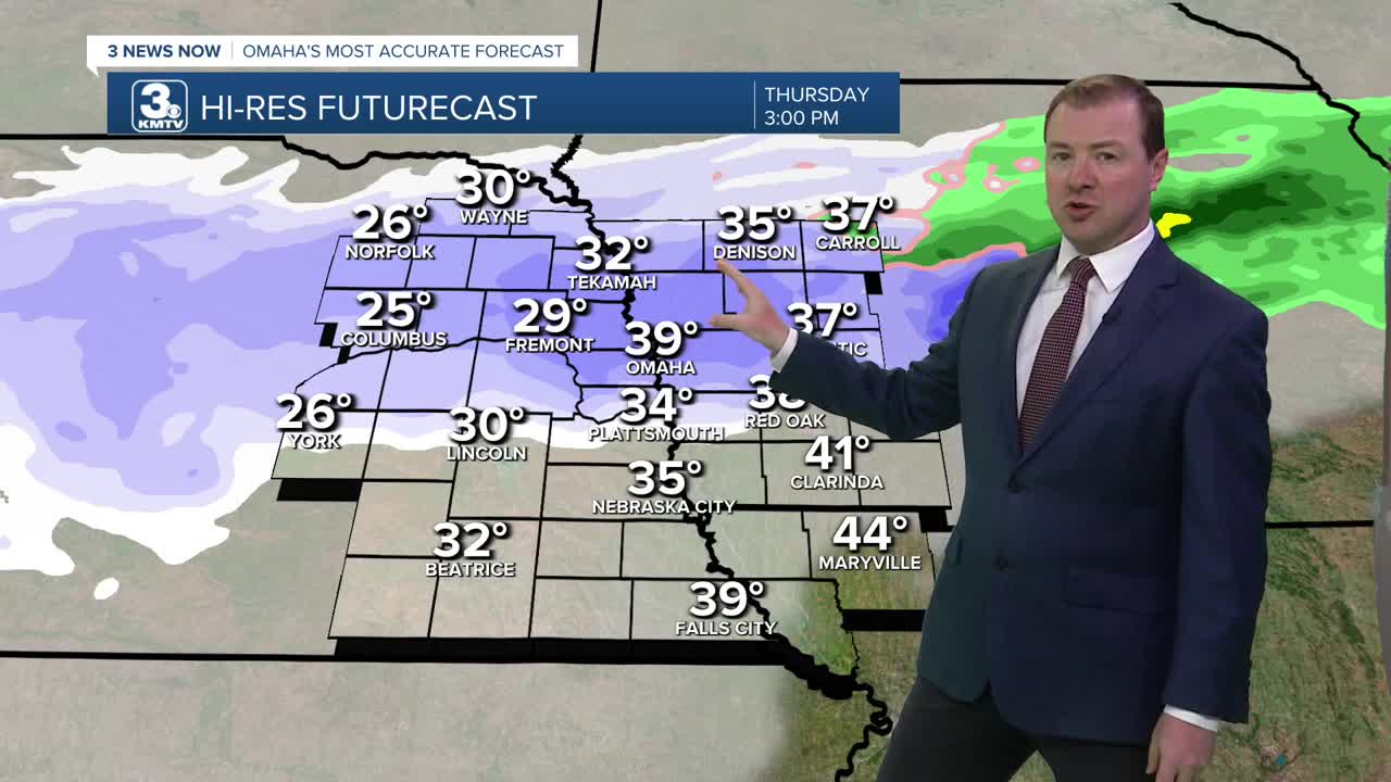
A light rain and snow mix will move into the region starting early Thursday morning, becoming widespread in the afternoon before changing over to all snow late in the afternoon, exiting late in the evening. It will be a breezy day with highs in the mid 40s south of Omaha, and only in the 30s in and north of Omaha. Winds could gust to around 35-40mph.
We are watching for the potential of snow squalls during the Thursday evening commute, so be aware of changing travel conditions.
Snow amounts will be around 1" for areas near and south of I-80, including Lincoln and Omaha. Areas north of Omaha could see 2" of snow, and perhaps up to 3" if the air is cold enough to prevent any snow from melting.
Roads may still be slick Friday morning, especially north of Omaha. But, the sunshine is back out on Friday, and it will be cool out with highs in the mid 30s.
This weekend should be mostly dry, but it will be cooler and closer to average with highs in the upper 30s. Nightly temperatures will drop in the upper 10s. The average high by February 20th is around 41 degrees.
WEDNESDAY NIGHT
Partly Cloudy
Getting Breezy
Low: 35
Wind: S 10-15
THURSDAY
Mostly Cloudy
Rain & Snow
Windy
High: 39
Wind: SW 15-35
FRIDAY
Mostly Sunny
Cool
High: 33
Wind: N 10-20
Share your weather pictures with KMTV:
- Email to News@3newsnow.com
- 3 News Now Facebook page
- Use the hashtag #3NewsNow on Instagram or X (formerly Twitter)
