

3 THINGS TO KNOW
- Temps in the 50s Saturday
- Damaging wind and snow possible Sunday
- Very cold heading into Monday morning
FORECAST
For the weekend, it starts partly to mostly cloudy and fairly dry Saturday, with south winds at up to 25 mph. It will be a little warmer out with highs in the upper 50s. Hold off on burning anything outdoors.
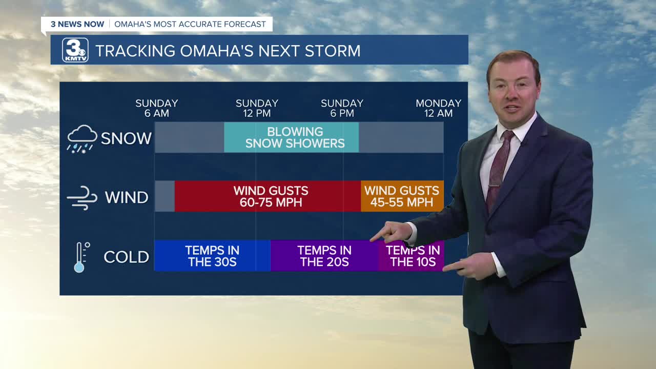
Sunday will be a very active weather day for Omaha, and damaging winds are possible in addition to snow.
Sustained winds will be around 30-35 mph, and wind gusts will likely be around 50-60 mph. A few of these gusts could reach 70+ mph. The high wind begins around 7-8am.
A rain to snow mix will begin late in the morning, after 9-10am, quickly turning to all snow for Sunday afternoon. Roads may be impacted as air temps drop from the 40s in the morning, to the 20s early in the afternoon. Snow accumulation will be around 1-2" for most. Areas north ans east of Omaha could see between 2-4" of snow. The snow ends early Sunday evening.
Near-blizzard conditions are possible during the day due to the high wind and low visibility. With winds exceeding 60 mph, tree and property damage, including power outages are possible Sunday.
The wind will weaken a little Sunday evening, gusting closer to 45 mph Sunday night.
Temperatures will be near 10 degrees by Monday morning. And it's a very cold start to next week, with highs in the 20s on Monday, returning to near 40 by Tuesday. There's a small chance for rain on Tuesday. By the end of the week, we are pushing highs in the 80s.
SATURDAY
Mostly Cloudy
Warmer
High: 59
Wind: SE 15-25
SUNDAY
Very Windy!
Snow Showers
8 AM Temps: 45
4 PM Temps: 25
Wind: N 35-65
Share your weather pictures with KMTV:
- Email to News@3newsnow.com
- 3 News Now Facebook page
- Use the hashtag #3NewsNow on Instagram or X (formerly Twitter)
