

A cold front moves in Thursday night, bringing a slight chance at rain, mainly after midnight. This cold front will also clear out the wildfire smoke.
It will be cooler and breezy with cloudy skies and a few spotty showers south of Omaha for the start of Friday morning.
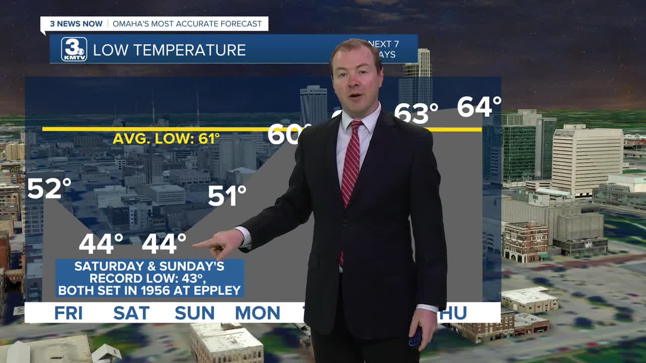
While there could be a couple leftover showers south of I-80 through noon, the rest of the day will be partly sunny and dry. It will be breezy as cooler air moves in behind the front, dropping highs into the upper 60s for Friday afternoon, followed by low to mid 40s heading into Saturday morning. Omaha's record low for 9/6 is 43º, set in 1956.
Saturday will be mostly sunny with highs only in the upper 60s over western Iowa, and nearing 70 over much of eastern Nebraska. If you're heading to the Huskers/Zips game in Lincoln, highs will be in the low 70s there.
Sunday will start cold again, near record lows in the low to mid 40s. Omaha's record low for 9/7 is 43º, also set in 1956. We warm back up to low 70s in the afternoon with sunshine.
Clouds will slowly start to move in as things begin to warm back up to normal next week. Monday will be partly cloudy with a very small chance at rain, and mid 70s, followed by upper 70s on Tuesday.
We'll keep the chance for rain around for next Wednesday, with highs nearing 80.
FRIDAY
Partly Sunny
Cool
High: 67
FRIDAY NIGHT
Mostly Clear
Cold
Record Low: 43
Low: 44
SATURDAY
Mostly Sunny
Below Average Temps
High: 69
SUNDAY
Mostly Sunny
Slightly Warmer
High: 71
Share your weather pictures with KMTV:
- Email to News@3newsnow.com
- 3 News Now Facebook page
- Use the hashtag #3NewsNow on Instagram or X (formerly Twitter)
