

3 THINGS TO KNOW
- A nice Wednesday
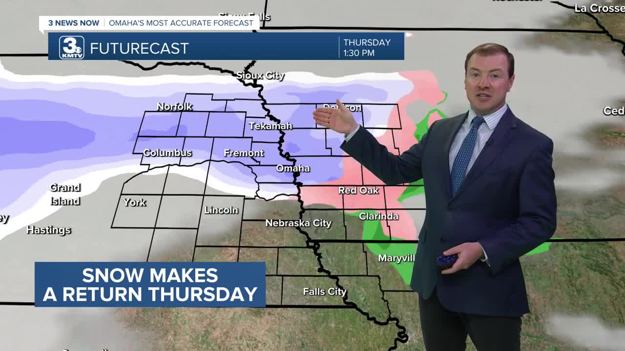
- Snow chance on Thursday
- Much cooler over the weekend
FORECAST
By Wednesday morning, skies will be mostly clear with temps in the mid 40s.
It will be sunny and a little cooler out on Wednesday, but still very mild for February. And less windy. We could be up near some record highs again, with highs in the mid 60s. The record is 70.
A rain and snow mix will move into the region starting early Thursday morning. If the air can stay cold enough, some of this snow could try to accumulate north of Omaha/I-80 during the day. Snowfall amounts will likely be around 1" or less. It will be a breezy day with highs in the mid 40s south of Omaha, and only in the 30s north of Omaha.
We are watching for the potential of snow squalls during the Thursday evening commute, so be aware of changing travel conditions.
Sunshine is back out on Friday, and it will be cool out with highs in the upper 30s.
This weekend should be mostly dry, but it will be cooler and closer to average with highs in the upper 30s. Nightly temperatures will drop in the upper 10s. The average high by February 20th is around 41 degrees.
WEDNESDAY
Mostly Sunny
Pleasant
High: 65
Wind: SW 15-20
WEDNESDAY NIGHT
Partly Cloudy
Getting Breezy
Low: 35
Wind: S 10-15
THURSDAY
Mostly Cloudy
Rain & Snow
Windy
High: 45
Wind: SW 15-35
Share your weather pictures with KMTV:
- Email to News@3newsnow.com
- 3 News Now Facebook page
- Use the hashtag #3NewsNow on Instagram or X (formerly Twitter)
