

Tonight, there is a chance for a few spotty thunderstorms over northeast Nebraska and northwest Iowa that could be capable of strong winds and a few pockets of large hail.
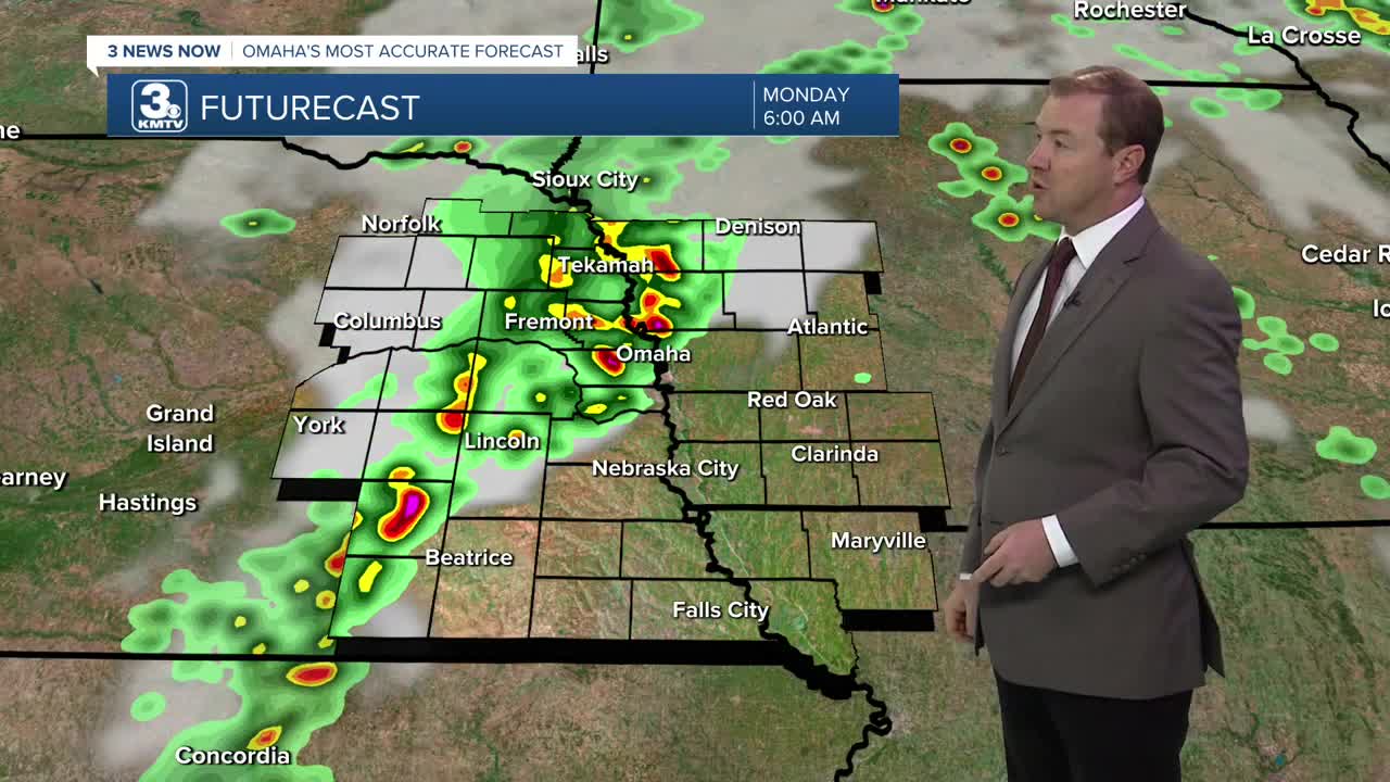
Heading into early Monday morning, a cold front will begin to inch closer to Omaha, bringing a line of showers and storms for the morning commute. The wind may be gusty as times as the storms roll in, but severe weather is not expected.
Scattered showers and storms will continue off and on through Monday afternoon, but there should be some dry-time. It will still be very warm and humid outside with highs in the low 90s, still feeling like the 100s outside.
By Monday night, the cold front will start to move through Omaha, bringing a slight chance at overnight storms.
Tuesday will be even cooler outside with highs in the mid to upper 80s and partly cloudy skies. There may be a few spotty showers around, but most of us will stay dry.
Wednesday and Thursday begins the cool-down, and it should begin to be less humid outside by mid-week, too. Highs will be in the mid 80s through Friday, followed by low 80s heading into next weekend.
MONDAY
Partly Sunny
Spotty AM & Late Storms
High: 91
MONDAY NIGHT
Mostly Cloudy
Rain & Storms
Low: 71
TUESDAY
Partly Cloudy
Spotty Storms
High: 87
WEDNESDAY
Mostly Sunny
Less Humid
High: 85
Share your weather pictures with KMTV:
- Email to News@3newsnow.com
- 3 News Now Facebook page
- Use the hashtag #3NewsNow on Instagram or X (formerly Twitter)
