

3 THINGS TO KNOW:
- Cold and Breezy Monday
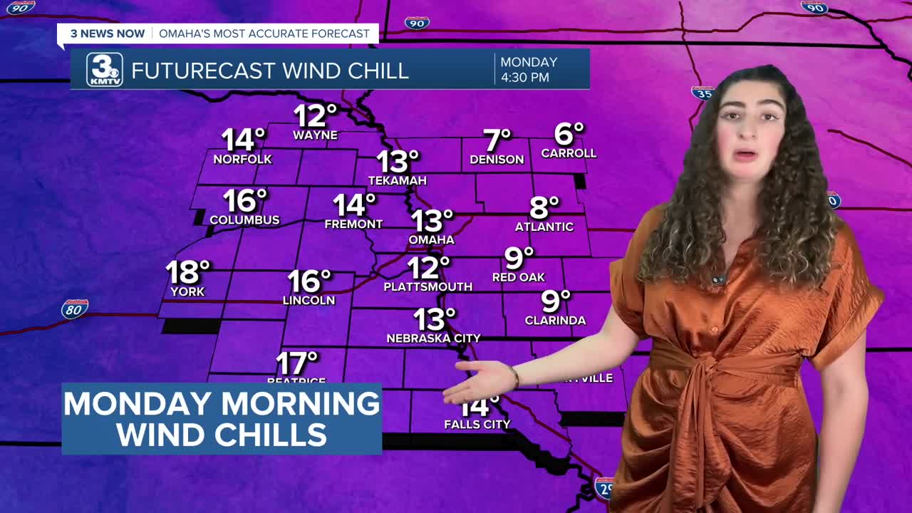
- Wind Chills Below Zero
- Another cool-down around New Years Day
FORECAST:
We are done with winter precipitation for a few days, but the winds will stay breezy and the cold air is here to stay.
Gusty northwest winds will be as strong as 35-40mph Sunday night as temperatures drop to around 8 to 12 degrees by Monday morning. Wind chills will be below zero tonight and for most of the morning.

Monday will be a mostly sunny day, but not very warm with highs in the low 20s, dropping in the low 10s Monday night. However, the wind will become calm Monday night.
Tuesday will be warmer and mostly sunny with highs returning to the low 40s.
We get to keep some of the less frigid air around for New Years Eve, but a cold front is expected to reach Omaha Wednesday night. As for now, precipitation is expected to remain east of the Omaha viewing area. By Thursday morning, we're back in the frigid cold, in the mid 10s.
New Years Day will be colder and mostly sunny with highs in the low 30s.
Our pattern appears to remain mainly dry for the rest of the week and this upcoming weekend. By Friday, we're back in the upper 30s, and we reach the low 40s again this weekend with mostly sunny skies.
We may see our next best chance at precipitation late this weekend, but the chance remains low for now.
MONDAY
Mostly Sunny
Cold & Windy
High: 24
Wind: NW 15-25
MONDAY NIGHT
Mostly Clear
Calmer Wind
Low: 12
Wind: NW 5-15
TUESDAY
Mostly Sunny
Warmer
High 41
Wind: SE 10-15
WEDNESDAY
Mostly Sunny
Cold & Windy
High: 42
Wind: SE 10-15
Share your weather pictures with KMTV:
- Email to News@3newsnow.com
- 3 News Now Facebook page
- Use the hashtag #3NewsNow on Instagram or X (formerly Twitter)
