

3 THINGS TO KNOW
- Wind and Cold Saturday, in the 10s
- Warmer, but still Windy Sunday
- A quieter start to next week
FORECAST
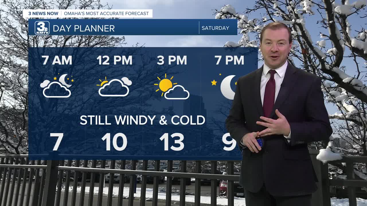
The weekend will start frigid around the region, and still windy Saturday with wind chills below zero all day. It will be a cloudy day, but we should see a little afternoon sunshine with highs in the 10s. Winds will begin to calm down Saturday evening.
We drop into the single digits Saturday night, but gradually warm up overnight as a warmer air mass moves into the region. This should get us into the upper 10s by the start of Sunday morning.
Sunday will be warmer, but windy with gusts up to 45 mph. And we could see more bands of snow showers during the day. Snow totals are not expected. Highs will reach the upper 30s. We get another cold front Sunday evening that will send our temperatures down in the single digits by Monday morning.
Monday will be a cold day once again, but not very windy and the sunshine will be back. Highs on MLK Day will be around the low 20s.
Tuesday will be evening warmer with partly cloudy skies and mid 30s for highs.
We get to keep the closer to average weather around for the rest of the week. Temperatures will be in the 30s from Wednesday through Friday. There is a chance for snow to return around Friday and into next weekend.
SATURDAY
Partly Cloudy
Cold & Windy
High: 13
Wind: NW 25-40
SUNDAY
Partly Cloudy
Chilly & Windy
High: 37
Wind: S 25-45
Share your weather pictures with KMTV:
- Email to News@3newsnow.com
- 3 News Now Facebook page
- Use the hashtag #3NewsNow on Instagram or X (formerly Twitter)
