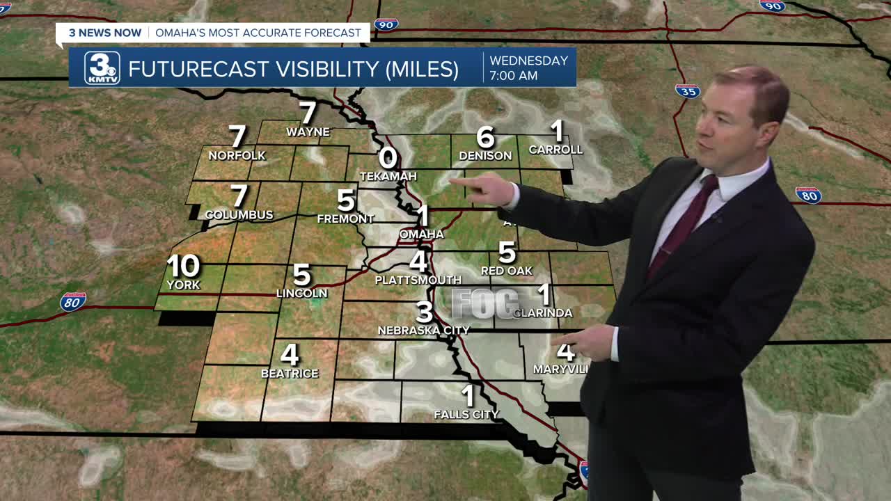


We stay mostly clear and comfortable for an August night. Temperatures will drop in the low 60s for Wednesday morning and there may be a little bit of patchy fog in the morning.
Wednesday will be mostly sunny and overall pretty quiet with highs in the mid 80s.
Late Wednesday night, a few storms may try and move in from South Dakota. This would clip our neighborhoods in northeast Nebraska if the rain can hold together long enough early into Thursday morning.
After any Thursday morning rain clears up, we'll be on to more sunshine and breezy winds with highs in the upper 80s. You'll probably notice the humidity more too.
Friday will be hot, humid, and breezy with low 90s and mostly sunny skies. Heat indices could reach the 100s for a few hours on Friday afternoon.
Saturday will be even warmer, with mid 90s and a lot of sunshine. Heat indices will once again likely top out in the 100s in the afternoon.
By late Saturday night, showers and storms will likely develop to our north, and could drift into northeast Nebraska and western Iowa
Sunday will have a better chance at scattered thunderstorms as a cold front starts to move into the region. We may have enough dry-time to reach the upper 80s.
We'll keep a slight chance for rain around for early next week, and it should be a little cooler outside with low to mid 80s on Monday and Tuesday.
WEDNESDAY
Mostly Sunny
Average
High: 86
WEDNESDAY NIGHT
Mostly Clear
Isolated Storms
North of Omaha
Low: 67
THURSDAY
Mostly Sunny
Breezy
High: 88
FRIDAY
Mostly Sunny
Breezy
High: 92
Share your weather pictures with KMTV:
- Email to News@3newsnow.com
- 3 News Now Facebook page
- Use the hashtag #3NewsNow on Instagram or X (formerly Twitter)
