

Skies will become mostly clear overnight we cool off into the low 60s for Thursday morning.
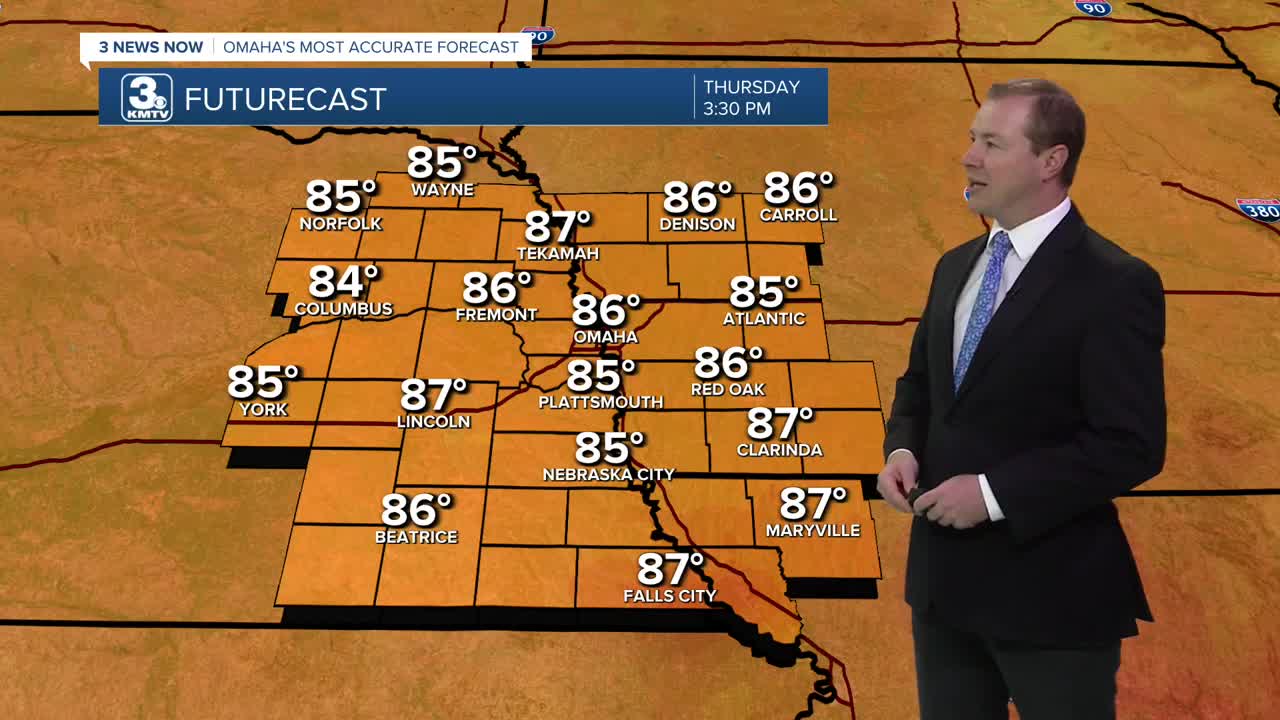
The quiet and sunny weather continues into Thursday, and we start heating up again into the upper 80s.
The wind will begin to pick up out from the south Friday, and temperatures are looking to reach the low 90s Friday afternoon under lots of sunshine. WE only get down in the upper 60s for Saturday morning.
The wind picks up even more for Saturday, gusting over 35 mph at times. It stays mostly sunny and hot with a high near 90.
A cold front will move in from the northwest Sunday. Before it gets here, we'll likely have time to warm up into the mid 80s with a mix of sun and clouds. Later in the afternoon, the cold front will kick off some hit and miss showers and storms, which will continue into Sunday evening. Severe weather is not expected at this time, and only about half of us will see the rain.
The hit and miss rain will continue for some of us into Monday as the cooler weather moves in behind the cold front. It will be a lot cooler out, and back to a more normal high for this time of year, in the low 70s.
The low 70s continue Tuesday and Wednesday with a small chance for rain.
THURSDAY
Mostly Sunny
Very Warm
High: 89
THURSDAY NIGHT
Mostly Clear
Comfortably Warm
Low: 64
FRIDAY
Mostly Sunny
Breezy
High: 91
SATURDAY
Mostly Sunny
Breezy
High: 90
Share your weather pictures with KMTV:
- Email to News@3newsnow.com
- 3 News Now Facebook page
- Use the hashtag #3NewsNow on Instagram or X (formerly Twitter)
