

Clouds will move into the region overnight, keeping temperatures closer to the upper 30s for Thursday morning.
The clouds will gradually clear on Thursday, leading to more afternoon sunshine and highs in the mid-60s.
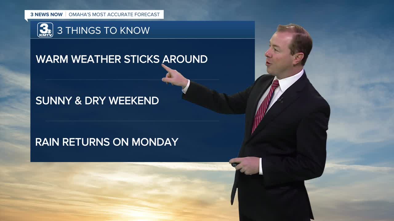
The warmest days this week look to be Friday & Saturday. Friday will be mostly sunny with highs in the low to mid 70s. The record is 76, set in 1964.
A dry cold front arrives as the weekend begins, ushering in slightly cooler air and breezy winds early Saturday morning. It will be mostly sunny on Saturday, with highs in the mid 60s, and in the upper 50s for Sunday.
Our next chance for rain may come early next week as a windy storm system reaches Nebraska and Iowa. Monday will be cloudy with highs in the 40s to low 50s.
Tuesday will be drier and partly cloudy with upper 40s for highs, followed by a low chance at more rain around next Wednesday and Thursday.
THURSDAY
Partly Cloudy
Warmer
High: 66
Wind: S 5-10
THURSDAY NIGHT
Mostly Clear
Warmer
Low: 42
Wind: SW 5-15
FRIDAY
Mostly Sunny
Warm
High: 74
Wind: S 5-10
SATURDAY
Mostly Sunny
Cooler & Breezy
High: 66
Wind:NW 10-15 G25
Share your weather pictures with KMTV:
- Email to News@3newsnow.com
- 3 News Now Facebook page
- Use the hashtag #3NewsNow on Instagram or X (formerly Twitter)
