

3 THINGS TO KNOW
- Rain with pockets of hail Thursday
- Drier on Friday
- Several rounds of storms this weekend
FORECAST
A cold front will continue to move through the region this evening. A few spotty rain showers are possible near the Nebraska and Kansas border this evening and tonight. The rest of the region stays dry, less windy and cooler with temps in the 40s overnight.
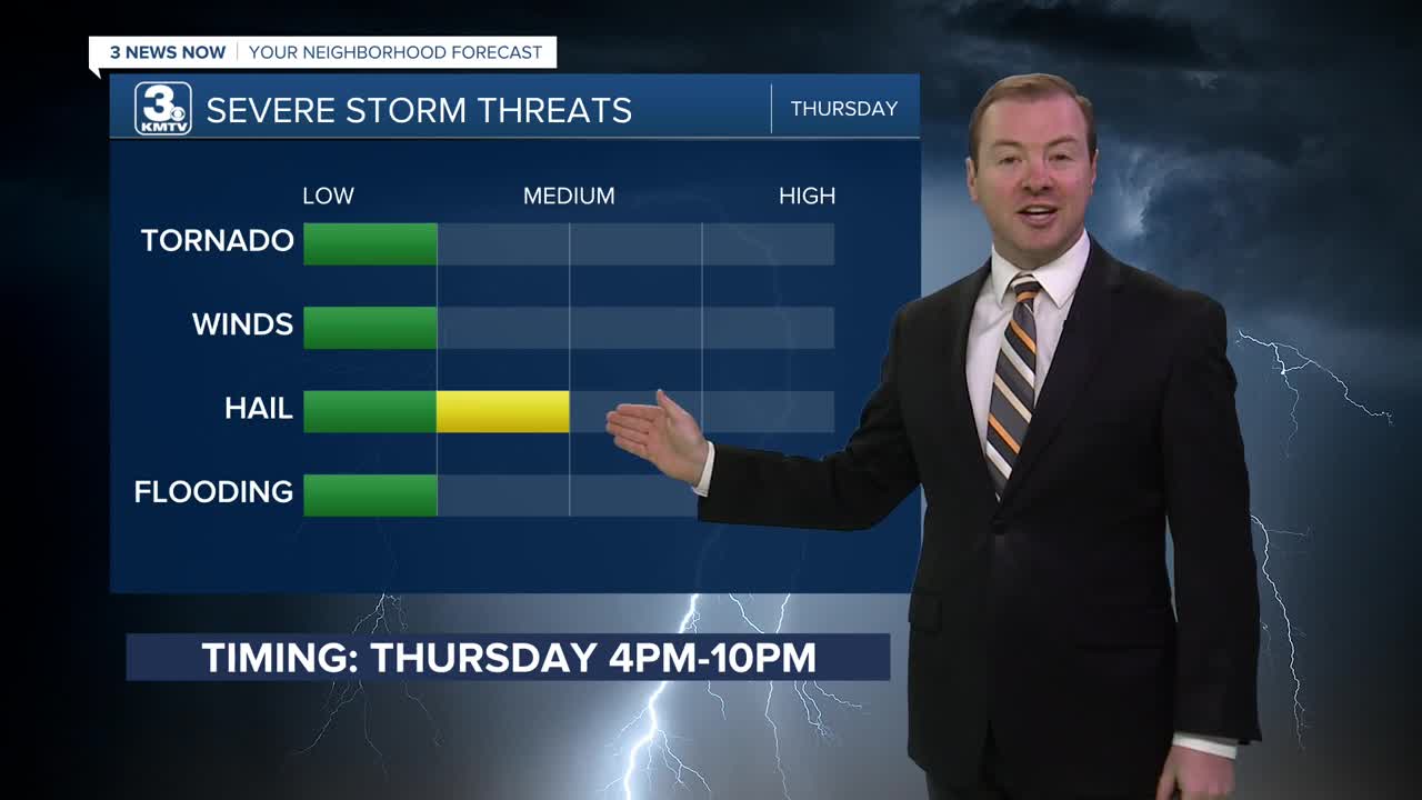
As the front stalls along the Nebraska and Kansas border tonight, we could see a few rounds of storms on Thursday, starting later in the morning, and a few could have hail in the afternoon and evening. The most probable locations to see hail will be south of Omaha/I-80.
This rain will slowly exit the region Thursday night, leaving Friday drier and partly sunny with highs near 60.
More stormy weather returns for the weekend, with off and on rounds of storms Saturday morning through Sunday evening. A few of these storms could be strong to severe with all types of weather possible, mainly on Sunday. It will be breezy with weekend and highs are expected to reach the 60s on Saturday and the 70s Sunday.
Estimated rainfall amounts will be around 0.50" to 1.00" through Sunday night.
It stays warmer than average, in the 80s on Monday, followed by another round of storms on Tuesday, cooling things off into the 60s for the middle of next week.
WEDNESDAY NIGHT
Mostly Cloudy
Less Windy
Low: 41
Wind: N 10-15
THURSDAY
Cloudy
Rain & Storms
High: 61
Wind: E 10-15
FRIDAY
Partly Sunny
Drier
High: 60
Wind: NE 10-15
Share your weather pictures with KMTV:
- Email to News@3newsnow.com
- 3 News Now Facebook page
- Use the hashtag #3NewsNow on Instagram or X (formerly Twitter)
