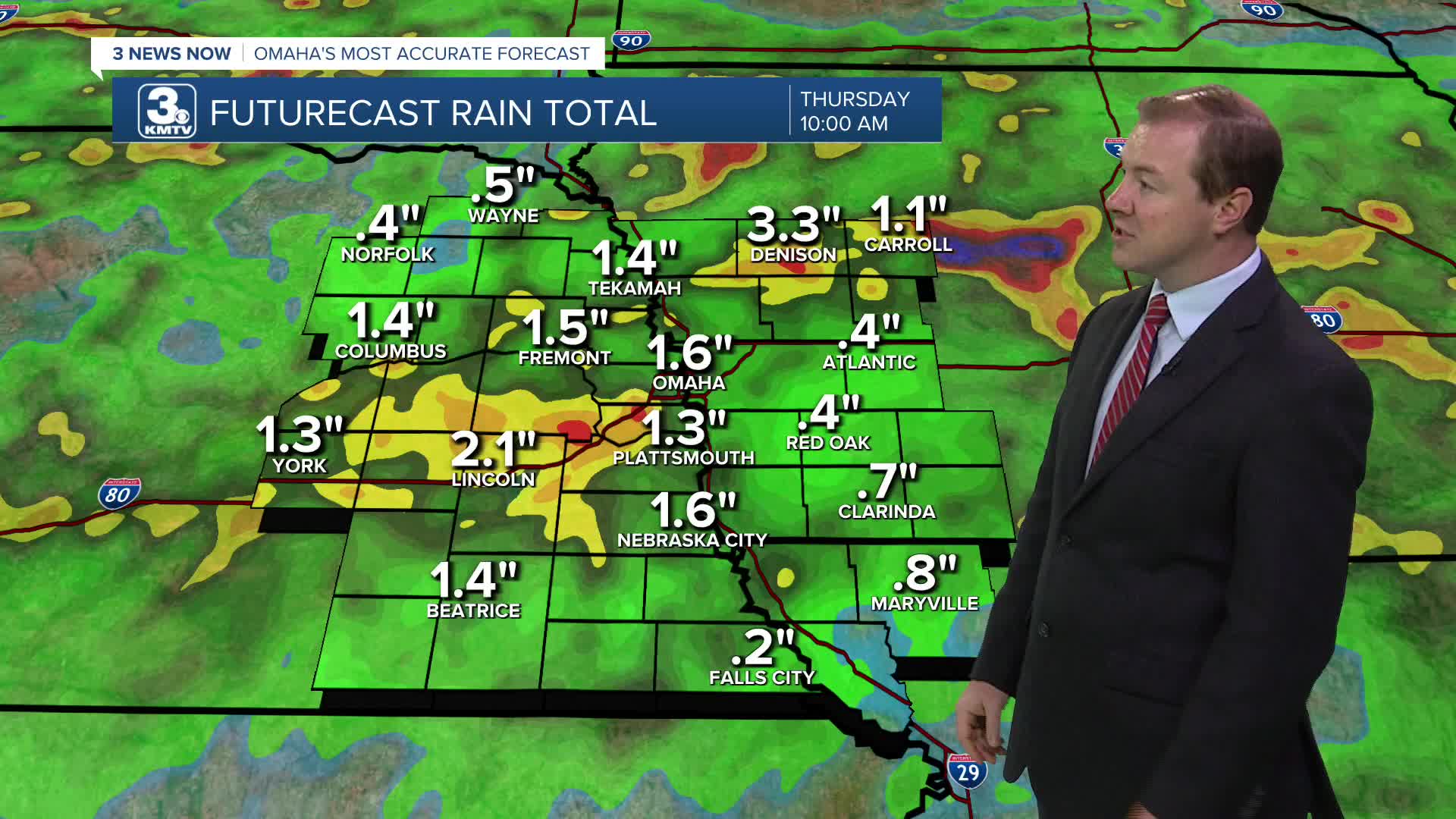


A flood watch has been issued by the National Weather Service for tonight, as 1.0" of rainfall may be common into Wednesday morning, and upwards of 3.0" to 4.0" could fall in some isolated cases, which may lead to flash flooding.
Storms will move into eastern Nebraska from the west closer to as we get closer to midnight. Some of these storms could reach severe levels. Damaging wind will be the most likely problem, which could cause power outages. A handful of neighborhoods could see a few inches of rain, making some brief flash flooding also possible until the drainage system catches up. The storms will weaken into Wednesday morning as they spread to areas farther southeast.
By the Wednesday morning commute, there will still be some a number of scattered showers around. The bulk of the rain will be in the first half of the day, but there will still be some hit and miss leftover showers around in the afternoon. While still humid, highs will only be in the upper 70s with mostly cloudy skies.
The humidity will start to fall more Thursday, but you'll probably still notice it. We stay cooler with upper 70s and a lot of clouds.
Friday brings a mix of sun and clouds, but we stay in the upper 70s.
We stay about 10 degrees below average Saturday as the upper 70s continue with some sunshine.
Sunday and Monday will be in the low 80s with at least a small chance for rain.
WEDNESDAY
Mostly Cloudy
Rain & Storms
High: 78
WEDNESDAY NIGHT
Mostly Cloudy
Drying Out
Low: 63
THURSDAY
Mostly Cloudy
Not as Humid
High: 78
FRIDAY
Partly Sunny
Comfortable
High: 78
Share your weather pictures with KMTV:
- Email to News@3newsnow.com
- 3 News Now Facebook page
- Use the hashtag #3NewsNow on Instagram or X (formerly Twitter)
