

3 Things to Know
- Hot & humid weather continues
- Storms with damaging wind over the next few nights
- May be a rainy and hot July 4th weekend
Forecast
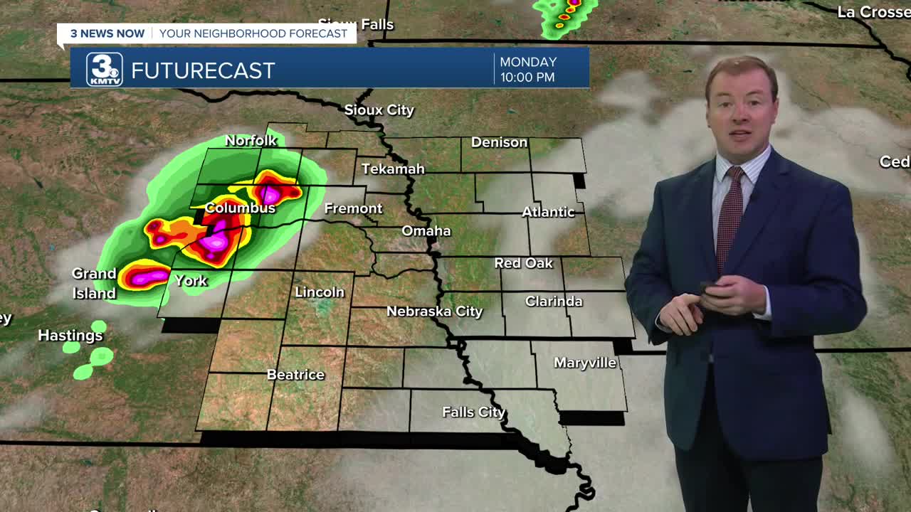
It will stay very hot, humid and breezy into Monday evening. After 7pm, a few isolated storm cells will develop in central Nebraska and will move into northeast Nebraska through 11pm to midnight. These storms could likely be severe with damaging winds and pockets of hail as the primary storm hazard.
Tuesday will still be a hot afternoon, but slightly less humid which also means lower heat indices closer to 100, not 105+. It will still be a sunny & windy day with highs in the low to mid 90s. Once again after 7-8pm, more storms will develop. This time, storms will be more spotty and could clip parts of Omaha.
Each evening this week, we have a chance of thunderstorms. Given the energy in the air from these hot & humid afternoons, these storms could be severe. The main concerns will be damaging wind gusts and large hail.
This scattered stormy pattern will continue through Thursday with partly sunny skies, breezy winds and highs in the low 90s, feeling more like 100.
Friday will probably be our last really hot and humid day where heat indices could top 105-110 again. Once again, storms will be possible Friday night after 8-10pm.
Be ready for some rain over the 4th of July holiday weekend. We could be looking at rain and storms as the weekend begins, including Saturday for the 4th. By Sunday, things are trending not just drier, but cooler with highs back down into the mid 80s.
MONDAY NIGHT
Isolated Storms
Very Warm
Low: 78
Wind: S 15-25
TUESDAY
Partly Cloudy
Breezy
Evening Storms
High: 95
Wind: SW 15-25
WEDNESDAY
Partly Cloudy
Spotty Storms
High: 91
Wind: S 15-25
Share your weather pictures with KMTV:
- Email to News@3newsnow.com
- 3 News Now Facebook page
- Use the hashtag #3NewsNow on Instagram or X (formerly Twitter)
