



3 Things to Know
- Above-normal temperatures continue
- Isolated rain possible Friday
- The cool-down hits early next week
Forecast
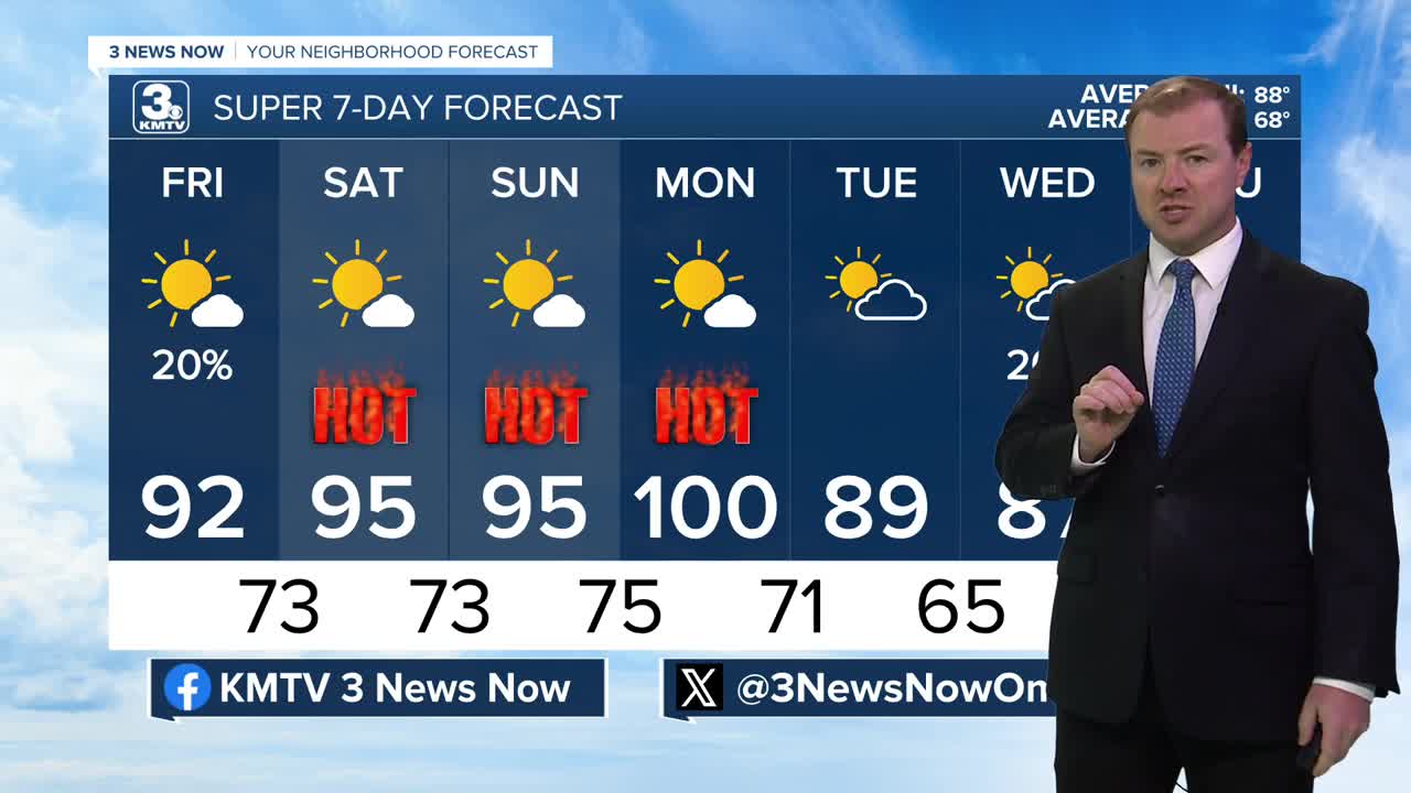
As the warmer than average heat builds into the region this week, remember to take breaks if you are working outside, and drink plenty of fluids. While the afternoon humidity will not be overly high, heat indices could still reach 95-100 at times this week. Thankfully, it looks like some relief is on the way towards the middle of next week!
Up north near Minnesota, Wisconsin, and Michigan, the air quality is hazardous due to some wildfire smoke. Here in Omaha, we're mostly under good and moderate air quality.
Some moisture drifting across the southern U.S. will spill into Omaha on Thursday and Friday, adding a few digits to the dew point, as well as a few extra clouds to our skies. We could even see some areas pick up on some isolated rain shower activity south of Omaha, from 4-8pm. Highs will reach the low 90s with a heat index around 95+.
Our temps will continue to climb this weekend and it's looking very sunny. Highs will be in the mid 90s with an afternoon heat index around 98-100.
We have better confidence that Monday will be the last day of this above-normal heat across the region. It will likely still gets very hot Monday afternoon with temps in the upper 90s, feeling more like 100-105. This "heat relief" should arrive sometime around Monday night in the form of a cold front, ushering in not only the anticipated cooler air, but a few chances at spotty rain.
We should start to see several chances at rain in the region later into next week as temps generally stay in the 80s.
THURSDAY NIGHT
Clear Skies
Patchy Fog
Low: 73
Wind: S 5-8
FRIDAY
Mostly Sunny
Isolated PM Rain
High: 92
Wind: S 5-10
SATURDAY
Mostly Sunny
Warm & Humid
High: 95
Wind: S 5-10
Share your weather pictures with KMTV:
- Email to News@3newsnow.com
- 3 News Now Facebook page
- Use the hashtag #3NewsNow on Instagram or X (formerly Twitter)
