

3 THINGS TO KNOW
- Small chances at rain
- Record highs possible again Wednesday
- Wetter pattern next week
FORECAST
Some light drizzle and a few sprinkles will be possible tonight, but nothing measurable. It stays cloudy tonight with Tuesday morning temps in the mid 30s.
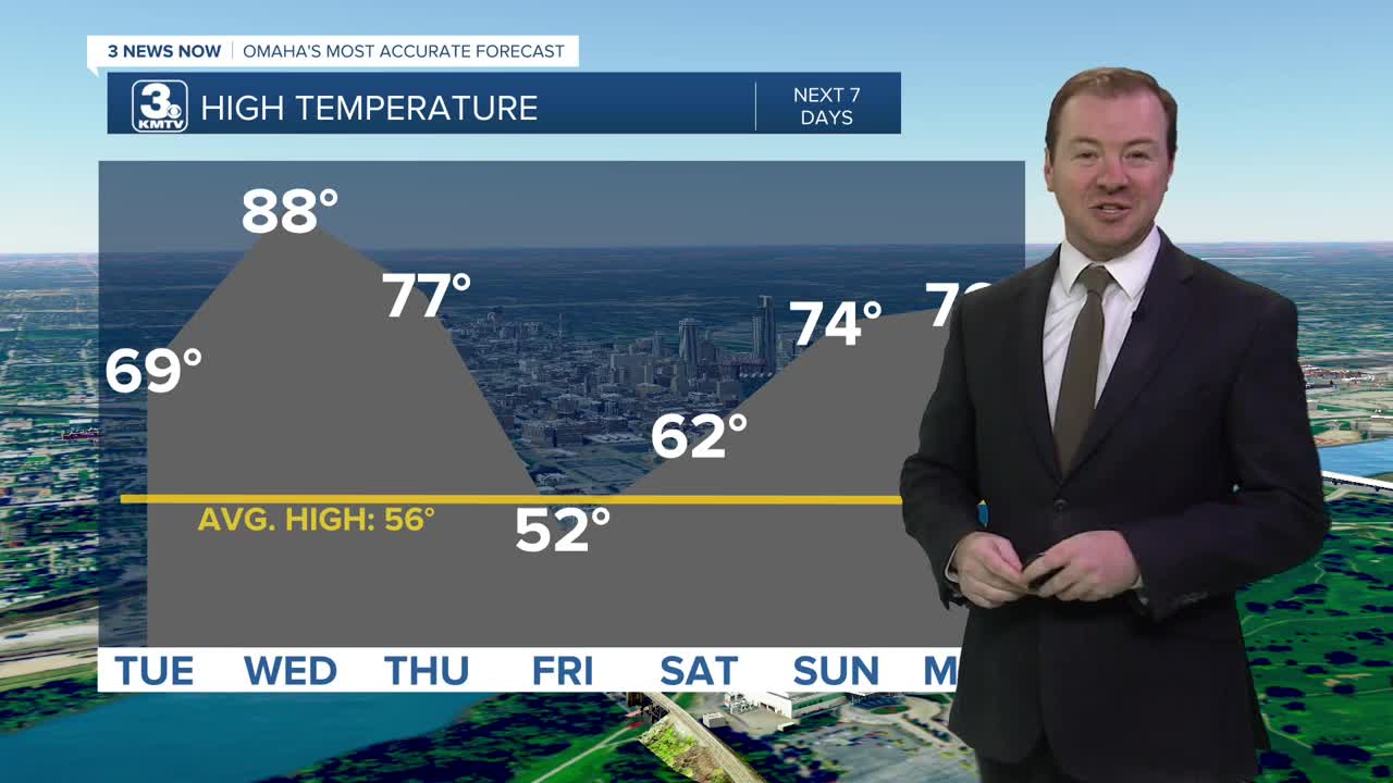
We'll see a mix of clouds and sunshine on Tuesday, and we start another warming trend as highs climb back in the upper 60s to low 70s.
It will feel like summer again on Wednesday and we could be near some records again with high in the upper 80s. Omaha and Lincoln's records are both 91º, set in 1907.
Thursday will be slightly cooler, but still very warm with upper 70s for highs. A cold front will pass through the region Thursday night, kicking up a few spotty rain showers. This rain will be hit-or-miss.
The cold front also brings gusty winds over 35 mph Thursday night, and cooler weather for Friday.
It will be mostly sunny on Friday with temps near 50, and lows in the upper 20s.
The weekend starts cold, but we're quickly back to above average temps with highs in the 60s on Saturday, and 70s on Sunday.
While it has been very dry recently, we are seeing signals for a wetter pattern next week.
MONDAY NIGHT
Partly Cloudy
Cold
Low: 35
Wind: NW 5-15
TUESDAY
Mostly Sunny
Warmer
High: 69
Wind: SE 5-15
WEDNESDAY
Mostly Sunny
Very Warm
High: 88
Wind: S 5-15
Share your weather pictures with KMTV:
- Email to News@3newsnow.com
- 3 News Now Facebook page
- Use the hashtag #3NewsNow on Instagram or X (formerly Twitter)
