
3 THINGS TO KNOW
- Cool, cloudy Thursday
- Bitter wind chills Friday
- More light snow possible Saturday night into Sunday
FORECAST
Snow did finally find the ground this morning, but most areas saw only a light dusting.
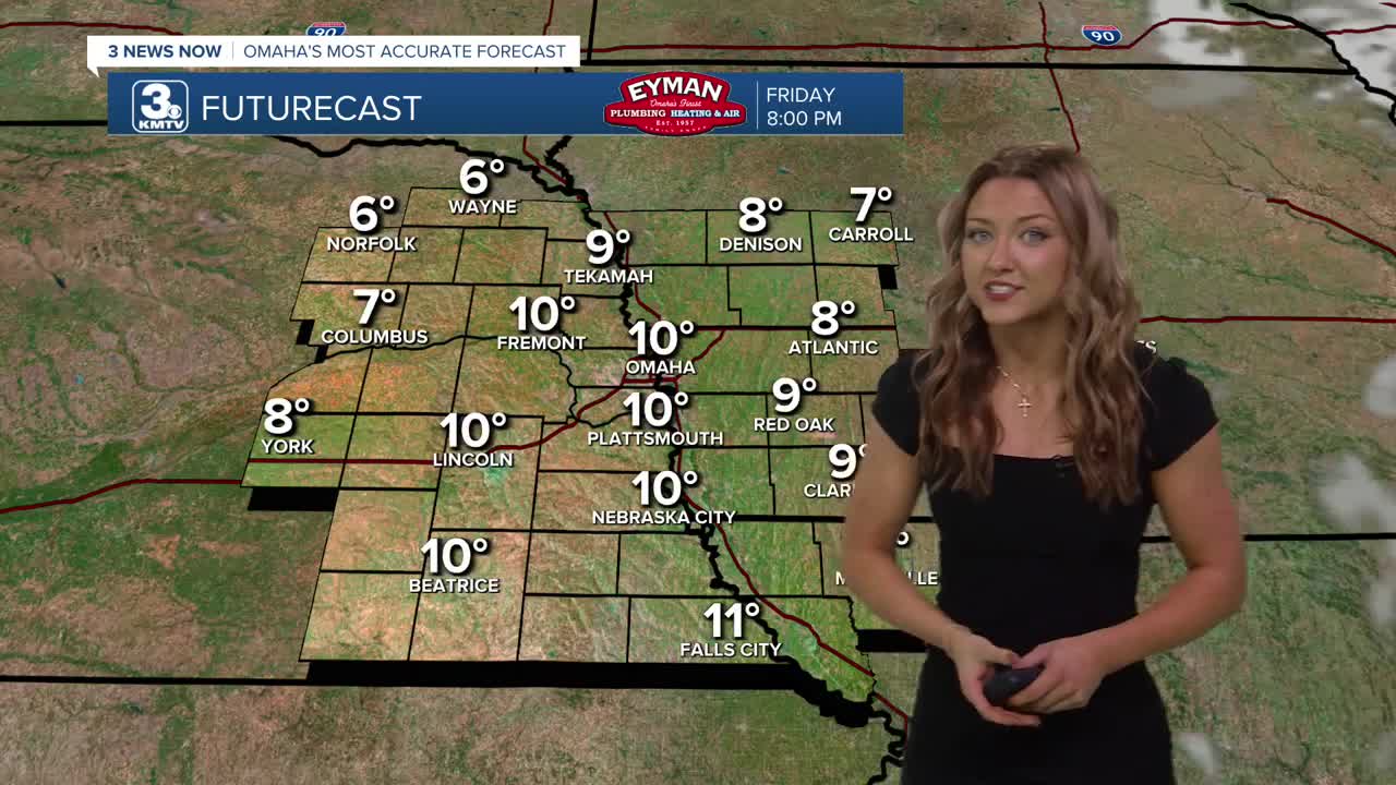
As that moves out, we're left with some colder temperatures. Thursday's highs will be in the low 20s, followed by highs only in the 10s on Friday. We may drop below zero Friday night.
By Friday morning, there's a small possibility to continue the light morning snow. However, so far it appears as most of this snow will remain to the east.
Heading into the weekend, there is another small chance for some light snow on Saturday night and on Sunday, amounts could tap out around 1-2 inches.
After staying cold, in the low 20s on Saturday, Sunday will be warmer in the 30s, making for a wetter snowfall and the possibility of sleet.
Travel impacts are not expected Saturday, but there could be some minor impacts depending on how heavy the snow is on Sunday.
If you are wanting even warmer weather, we should have that next week. Starting next Monday, temperatures will be closer to 40 degrees.
THURSDAY
Mostly Cloudy
AM Snow Showers
High: 23
Wind: NE 5-10
THURSDAY NIGHT
Mostly Cloudy
Dipping Temps
Low: 7
Wind: NE 5-10
FRIDAY
Partly Cloudy
Cold
High: 15
Wind: NE 10-15
Share your weather pictures with KMTV:
- Email to News@3newsnow.com
- 3 News Now Facebook page
- Use the hashtag #3NewsNow on Instagram or X (formerly Twitter)
