

It will be a chilly night, and patchy frost will be possible, as temperatures drop into the upper 30s for Tuesday morning.
The warm-up continues Tuesday with a high near 70 and mostly sunny skies.
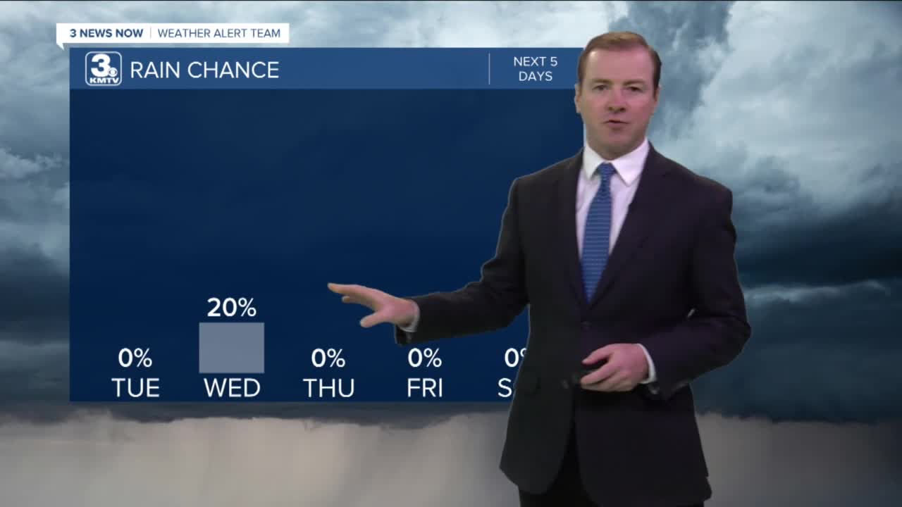
A cold front will arrive Wednesday morning, bringing clouds and and slightly cooler air. Rain will be limited with this mid-week system, but some scattered showers are possible during the day. It will be a breezy day with highs in the upper 60s and winds gusting to around 35mph.
Thursday will be slightly cooler, mostly cloudy and less windy. We might get some afternoon sunshine, but highs will only reach the low to mid 60s.
The beginning of the weekend will be sunny and warmer. Highs on Friday will return to near 70 degrees.
We'll see lots of sunshine with weekend with highs near 70 again on Saturday, cooling in the mid 60s on Sunday
TUESDAY
Mostly Sunny
Warmer
High: 70
TUESDAY NIGHT
Increasing Clouds
Breezy
Low: 51
WEDNESDAY
Mostly Cloudy
Isolated Showers
Breezy
High: 68
THURSDAY
Partly Cloudy
Mainly Dry
High: 65
Share your weather pictures with KMTV:
- Email to News@3newsnow.com
- 3 News Now Facebook page
- Use the hashtag #3NewsNow on Instagram or Twitter
Download the free Storm Shield app for ANY type of phoneReceive severe weather watches and warnings for your location as you track the storms on radar. Great for use at the office, at home, and while traveling.
