

3 THINGS TO KNOW:
- Near 60 and breezy Monday
- Record highs possible on Christmas Day
- Mostly dry until after this weekend
FORECAST:
Christmas week is looking not just warmer than average for this time of December, when the average highs are now around 36 degrees, but near some of our record highs!
Records
Monday : 63 (1933)
Tuesday: 67 (1964
Wednesday: 68 (1889)
Thursday: 57 (1946)
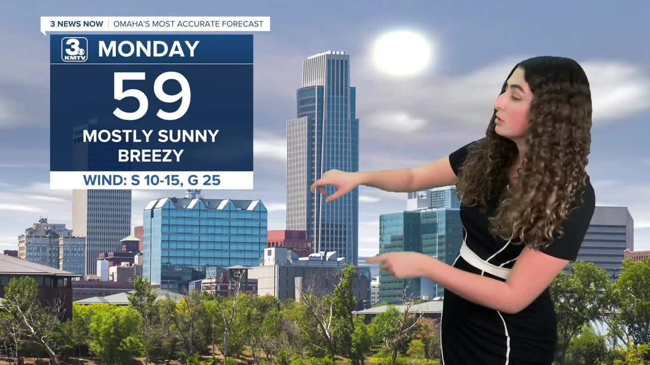
Monday will be mostly sunny and breezy with highs in the upper 50s. A few neighborhoods may reach the lower 60s.
We'll see some extra cloud cover on Tuesday and the wind should be calmer, with highs in the mid 50s.
Wednesday is Christmas Eve, and it's looking cloudy, but we keep the warmer air around. With temperatures in the upper 50s, if we are to see any light precipitation, it would be drizzle and rain.
Christmas Day is Thursday, and Omaha's chance for a "white Christmas" appears near zero...However, we are looking at potential record highs! Right now, we should be in the lower 60s, possibly warmer. The record high for Christmas Day is 57, set in 1946.
Friday may start out a little breezy as cooler air moves back into the region. We stay mostly sunny with highs in the lower 50s.
This weekend will continue the drier, and warmer than average pattern, but it will be a even cooler than this this past week. Saturday and Sunday will be partly sunny, i nthe upper 40s.
The next chance for any measurable precipitation, including rain or snow would be the weekend after Christmas. Until then, travel disruptions for the region appear low at this time.
MONDAY
Mostly Sunny
Warm & Breezy
High: 59
Wind: S 15-25
MONDAY NIGHT
Partly Cloudy
Getting Cooler
Low: 34
Wind: NW 10-20
TUESDAY
Partly Sunny
Slightly Cooler
High: 54
Wind: S 15-25
WEDNESDAY
Cloudy
Light Drizzle
High: 57
Wind: S 5-15
Share your weather pictures with KMTV:
- Email to News@3newsnow.com
- 3 News Now Facebook page
- Use the hashtag #3NewsNow on Instagram or X (formerly Twitter)
