

3 THINGS TO KNOW
- Rain exits Monday night
- Cooler than average mid-week
- Next rain chance comes Thursday/Friday
FORECAST
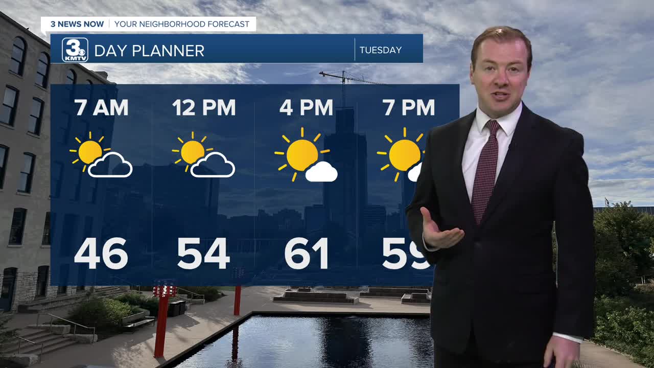
Rain showers will continue to slowly exit the region overnight and we are starting Tuesday morning cool, in the mid 40s.
Tuesday will start cloudy, but we should get some sunshine in the afternoon. It's a very cool day with highs in the low 60s. We'll have a few extra clouds Wednesday with highs in the mid 60s.
With the cooler temperatures Tuesday night in the upper 30s to low 40s, the could be a few areas of patchy frost in northeast Nebraska. The Omaha metro will likely NOT see frost.
Some rain will be possible Thursday and Friday, and we could see another 0.25" or more of rainfall.
The upcoming Memorial Day weekend looks sunnier, warmer with temperatures climbing back into the 70s and 80s.
MONDAY NIGHT
Cloudy
Storms until 12am
Low: 46
Wind: NW 5-15
TUESDAY
Partly Sunny
Cool and Dry
High: 61
Wind: NW 10-25
WEDNESDAY
Partly Cloudy
Cool
High: 63
Wind: CALM
Share your weather pictures with KMTV:
- Email to News@3newsnow.com
- 3 News Now Facebook page
- Use the hashtag #3NewsNow on Instagram or X (formerly Twitter)
