

3 THINGS TO KNOW:
- Rain and snow mix Saturday
- Cold again Sunday
- A warming trend for next week
FORECAST:
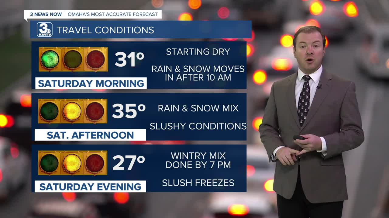
It will be a mostly cloudy and foggy start to Saturday morning, but most of east Nebraska and western Iowa will be dry through 9 AM.
A light wintry mix of rain and snow will move in from the west by late Saturday morning, and will become widespread Saturday afternoon, coming to an end early Saturday evening.
Roads may be a little slick as this system initially moves in during the late morning.
There is a good chance Omaha and areas south of I-80 see mostly rain with a little snow mixing in, whereas north of Omaha will be mostly wet snow.

That's where most of our snow on Saturday will be: north of Omaha, where 1-3" of wet snow will be possible, especially closer to Wayne/Pender, Nebraska and Denison/Carroll, Iowa.
Around Omaha, due to the rain mixing in, snow amounts around the Metro will be around 1/2". South of Omaha may only see a dusting of slushy snow.
Travel: Even with the rain, conditions will likely be slick at times with many roads becoming slushy and snow-covered Saturday afternoon. Any standing water or slush will freeze Saturday night.
By Sunday, it will be cloudy, breezy and colder. We start Sunday in the 10s and only warm to around 18 degrees. Sunday night will be frigid with lows in the single digits.
Monday will be mostly sunny, in the mid-30s. Tuesday will be even warmer with low 40s. We do cool off a little next Wednesday and Thursday, and there is a chance of rain and snow mid-week, but highs are expected to remain in the mid-30s, above freezing.
SATURDAY
Mostly Cloudy
Afternoon Rain and Snow
High: 35
Wind: SE 7-15
SATURDAY NIGHT
Mostly Cloudy
Breezy and Colder
Low: 17
Wind: NW 15-25
SUNDAY
Mostly Cloudy
Snow Flurries
High: 18
Wind: N 10-20
MONDAY
Mostly Sunny
Warmer
High: 36
Wind: S 10-20
Share your weather pictures with KMTV:
- Email to News@3newsnow.com
- 3 News Now Facebook page
- Use the hashtag #3NewsNow on Instagram or X (formerly Twitter)
