

3 THINGS TO KNOW
- Snow showers end Thursday night
- Travel impacts are likely
- Much cooler over the weekend
FORECAST
Snow showers will come to an end overnight, and skies will begin to clear after about 3-4am. This allows for temps to drop in the mid 10s for Friday morning.
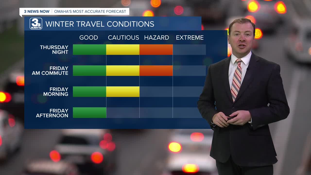
Travel conditions will likely remain poor around the region overnight and for the Friday morning commute. Roads will likely remain snow-covered and slick, so drive slow to get where you need to go.
The sunshine is back out on Friday, and that should help with the clearing of snow from Omaha's roads. It will be cool out with highs in the mid 20s.
This weekend will be dry and cool for late February, but we'll see plenty of sunshine. Saturday will be partly cloudy with highs near 30.
We'll be a touch cooler, and breezy Sunday with highs in the upper 20s. Sunday night gets cold, droping in the single digits by Monday morning.
Next week begins another big warm-up for the region. We stay cool Monday, in the 30s, before jumping in the 50s on Tuesday.
The rest of next week will likely be even warmer, reaching the mid 50s Wednesday, and even the 60s Thursday. These warmer temps will likely help melt all of the snow we received yesterday.
THURSDAY NIGHT
Mostly Cloudy
Snow Showers until Midnight
Low: 16
Wind: N 15-25
FRIDAY
Mostly Sunny
Cool
High: 26
Wind: N 10-20
SATURDAY
Partly Sunny
Cool
High: 31
Wind: N 5-15
Share your weather pictures with KMTV:
- Email to News@3newsnow.com
- 3 News Now Facebook page
- Use the hashtag #3NewsNow on Instagram or X (formerly Twitter)
