

3 Things to Know
- Near average temps this week
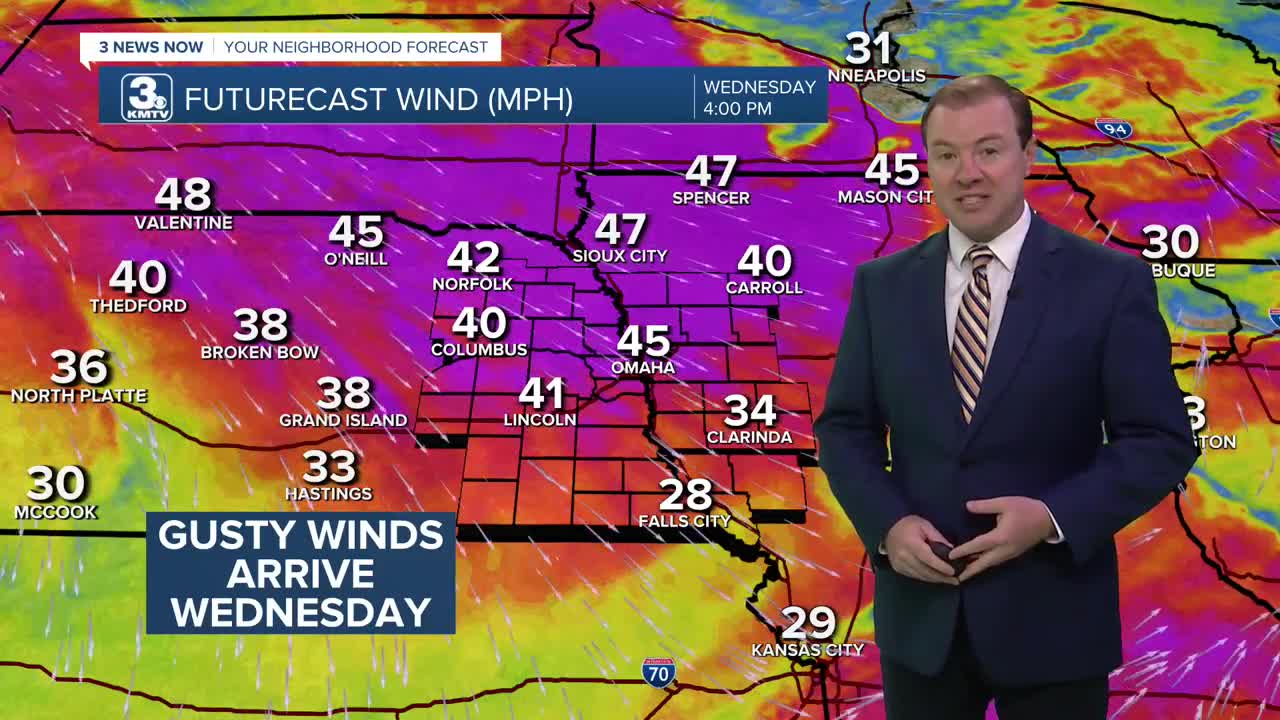
- Windy Wednesday with gusts around 45mph
- A few rounds of storms this weekend
Forecast
Monday evening looks great! And it may be a little cool outside with temps overnight near the upper 50s.
We may see a few isolated rain showers early Tuesday morning, but most, if not all of us will be dry. Tuesday looks like a great weather day with mostly sunny skies and highs in the low 80s. Clouds will move in Tuesday evening.
Wednesday will be an active weather day for Omaha. We have the chance for a few spotty thunderstorms in the morning until 10-11 AM. A few of those storms may be strong across western Iowa, but it looks like we will mainly dodge the severe weather chance.
Then, it gets windy and hot! Winds will be gusting out from the west and northwest at around 45mph. By Wednesday afternoon, we will have a partly to mostly sunny sky with highs near 90 degrees, cooling off into the low 60s with breezy winds Wednesday night.
The wind quiets down by Thursday and it will be a milder day with highs in the upper 70s to low 80s.
Friday is a little warmer with more sunshine and highs in the mid 80s.
Father's Day weekend is looking wet, with a few round of scattered storms on Saturday and Sunday. So, be ready to dodge the rain if you have weekend plans.
MONDAY NIGHT
Partly Cloudy
Isolated Rain
Low: 59
Wind: NW 5-15
TUESDAY
Mostly Sunny
Warmer
High: 82
Wind: NW 10-20
WEDNESDAY
Partly Cloudy
Windy
Morning Storms
High: 90
Wind: NW 25-45
Share your weather pictures with KMTV:
- Email to News@3newsnow.com
- 3 News Now Facebook page
- Use the hashtag #3NewsNow on Instagram or X (formerly Twitter)
