

3 THINGS TO KNOW:
- Warmer weather returns Tuesday & Wednesday
- Another cool-down on New Year's Day
- Staying rain and snow free for a few days
FORECAST:
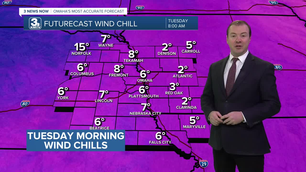
It will be a cold start to the day Tuesday. Temperatures will be around 10 to 15 degrees. Even though the wind will be relatively calm, it could feel like 5 degrees in the morning.
Warmer air moves back into the region Tuesday, and it does not come with much wind. Tuesday will be mostly sunny with highs returning to the low 40s.
We get to keep some of the less frigid air around for New Year's Eve, with highs on Wednesday reaching the mid 40s.
If you have plans for New Years Eve, it will be seasonably cool in Omaha, near 32 degrees Wednesday evening.
A cold front is expected to reach Omaha late Wednesday night. Currently, precipitation is expected to remain east of the Omaha viewing area. By Thursday morning, we're back in the frigid cold, in the upper 10s
New Year's Day will be colder and mostly cloudy with highs in the low 30s. We'll drop in the upper 10s for Thursday night.
Our pattern appears to remain mainly dry for the rest of the week and this upcoming weekend. By Friday, we're back in the upper 30s, and we reach the low 40s again this weekend with mostly sunny skies. Highs on Sunday could approach 50.
TUESDAY
Mostly Sunny
Warmer
High: 43
Wind: S 5-10
NEW YEAR'S EVE
Mostly Sunny
Above Average
High: 45
Wind: NW 5-10
NEW YEAR'S DAY
Partly Sunny
Cooler
High: 33
Wind: NW 5-15
Share your weather pictures with KMTV:
- Email to News@3newsnow.com
- 3 News Now Facebook page
- Use the hashtag #3NewsNow on Instagram or X (formerly Twitter)
